Poquott
| Poquott | |
|---|---|
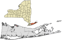 Lage im Suffolk County (New York) | |
| Basisdaten | |
| Staat: | Vereinigte Staaten |
| Bundesstaat: | New York |
| County: | Suffolk County |
| Koordinaten: | 40° 57′ N, 73° 5′ W40.9529435-73.09030279Koordinaten: 40° 57′ N, 73° 5′ W |
| Zeitzone: | Eastern (UTC−5/−4) |
| Einwohner: | 903 (Stand: 2020) |
| Haushalte: | 389 (Stand: 2020) |
| Fläche: | 1,5 km² (ca. 1 mi²) davon 1,1 km² (ca. 0 mi²) Land |
| Bevölkerungsdichte: | 821 Einwohner je km² |
| Höhe: | 9 m |
| Postleitzahl: | 11733 |
| Vorwahl: | +1 631 |
| FIPS: | 36-59157 |
| GNIS-ID: | 2391073 |
| Website: | www.poquott.org |
Poquott ist ein Ort an der Nordküste von Long Island im US-Bundesstaat New York. Er hat den Status eines incorporated village (selbstverwalteten Dorfs) innerhalb der Town of Brookhaven im Suffolk County. Nach dem Census von 2010 hatte das Dorf 953 Einwohner.
Geographie
Poquott hat eine Fläche von 1,5 km², davon 1,1 km² Land- und 0,4 km² Wasserfläche. Es liegt auf einer Landzunge, die die Nebenbucht Setauket Harbor vom Port Jefferson Harbor trennt, der wiederum eine Nebenbucht des Long-Island-Sunds ist. Es grenzt südlich an Setauket-East Setauket und östlich an Port Jefferson.
Der Ort besteht ausschließlich aus einem locker bebauten Wohngebiet.
Geschichte
Als Gründungsjahr, also Zeitpunkt der ersten Bebauung durch europäische Siedler, gilt 1659. Dabei hieß der Ort anfangs George's Neck nach einem George Wood, der am 23. Juli 1662 am Ufer eine Taverne für die nahe Setauket-Siedlung eröffnete. Die erste offizielle Erwähnung in den Stadtarchiven datiert vom 6. Januar 1668. Der heutige Ortsname stammt von einem indianischen Ausdruck für freies oder gerodetes Land. 1679 wurde das Gebiet in Parzellen aufgeteilt, an denen sich die spätere Bebauung orientierte. Im Britisch-Amerikanischen Krieg wurde hier 1812 ein kleines Fort errichtet. 1931 wurde das Dorf inkorporiert.
Infrastruktur
Poquott verfügt nur über kleinere lokale Straßen und keine eigene Anbindung an Bahn- oder Buslinien.
Weblinks
- Offizielle Website
- Newsday.com zur Ortsgeschichte
V
Orte im Suffolk County im US-Bundesstaat New York| Towns | Babylon • Brookhaven • East Hampton • Huntington • Islip • Riverhead • Shelter Island • Smithtown • Southampton • Southold | |
| Villages | Amityville • Asharoken • Babylon • Belle Terre • Bellport • Brightwaters • Dering Harbor • East Hampton • Greenport • Head of the Harbor • Huntington Bay • Islandia • Lake Grove • Lindenhurst • Lloyd Harbor • Nissequogue • North Haven • Northport • Ocean Beach • Old Field • Patchogue • Poquott • Port Jefferson • Quogue • Sag Harbor (New York) • Sagaponack • Saltaire • Shoreham • Southampton • Village of the Branch • West Hampton Dunes • Westhampton Beach | |
| CDPs | Amagansett • Aquebogue • Baiting Hollow • Bay Shore • Bayport • Baywood • Blue Point • Bohemia • Brentwood • Bridgehampton • Brookhaven • Calverton • Captree • Center Moriches • Centereach • Centerport • Central Islip • Cold Spring Harbor • Commack • Copiague • Coram • Cutchogue • Deer Park • Dix Hills • East Farmingdale • East Hampton North • East Islip • East Marion • East Moriches • East Northport • East Patchogue • East Quoque • East Setauket • East Shoreham • Eastport • Eatons Neck • Elwood • Farmingville • Fire Island • Fishers Island • Flanders • Fort Salonga • Gilgo • Gordon Heights • Great River • Greenlawn • Greenport West • Halesite • Hampton Bays • Hauppauge • Holbrook • Holtsville • Huntington • Huntington Station • Islip (CDP) • Islip Terrace • Jamesport • Kings Park • Lake Ronkonkoma • Laurel • Manorville • Mastic (CDP) • Mastic Beach • Mattituck • Medford • Melville • Middle Island • Miller Place • Montauk • Moriches • Mount Sinai • Napeague • Nesconset • New Suffolk • North Amityville • North Babylon • North Bay Shore • North Bellport • North Great River • North Lindenhurst • North Patchogue • North Sea (CDP) • Northampton • Northville (CDP) • Northwest Harbor • Noyack • Oak Beach • Oakdale • Orient • Peconic • Port Jefferson Station • Quiogue • Remsenburg-Speonk • Ridge (CDP) • Riverhead • Riverside • Rocky Point • Ronkonkoma • St. James • Sayville • Selden • Setauket • Shelter Island • Shelter Island Heights • Shinnecock (CDP) • Shirley • Smithtown • Sound Beach • South Huntington • Southold (CDP) • Springs • Stony Brook • Stony Brook University • Terryville • Tuckahoe • Wading River • Wainscott • Water Mill • West Babylon • West Bay Shore • West Hills • West Islip • West Sayville • Westhampton • Wheatley Heights • Wyandanch (CDP) • Yaphank | |
| Reservate | Poospatuck Reservation • Shinnecock Reservation |


