Wall (South Dakota)
| Wall | |
|---|---|
 | |
| Lage im County und in South Dakota | |
 | |
| Basisdaten | |
| Gründung: | 1908 |
| Staat: | Vereinigte Staaten |
| Bundesstaat: | South Dakota |
| County: | Pennington County |
| Koordinaten: | 44° 0′ N, 102° 14′ W43.991666666667-102.24083333333861Koordinaten: 44° 0′ N, 102° 14′ W |
| Zeitzone: | Mountain (UTC−7/−6) |
| Einwohner: | 699 (Stand: 2020) |
| Haushalte: | 299 (Stand: 2020) |
| Fläche: | 5,7 km² (ca. 2 mi²) davon 5,6 km² (ca. 2 mi²) Land |
| Bevölkerungsdichte: | 125 Einwohner je km² |
| Höhe: | 861 m |
| Postleitzahl: | 57790 |
| Vorwahl: | +1 605 |
| FIPS: | 46-68380 |
| GNIS-ID: | 1262653 |
| Website: | www.wallsd.us |
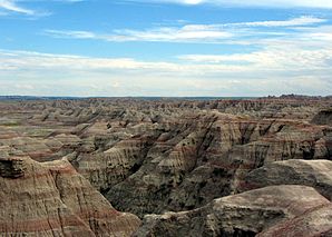 Badlands-Nationalpark | |
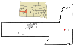
Wall (Lakota Makȟóšiča Aglágla Otȟuŋwahe) ist eine Town im Pennington County, South Dakota in den Vereinigten Staaten. Das U.S. Census Bureau hat bei der Volkszählung 2020 eine Einwohnerzahl von 699[1] ermittelt.
Der Ort liegt ca. 10 km nördlich des Badlands-Nationalparks an der Teilung der U.S. Highway 14 von der Interstate 90.
Weblinks
Commons: Wall (South Dakota) – Sammlung von Bildern, Videos und Audiodateien
- Wall Badlands Area Chamber of Commerce Touristische Informationen (englisch)
- Badlands-Nationalpark (englisch)
Einzelnachweise
- ↑ Explore Census Data Total Population in Wall town, South Dakota. Abgerufen am 18. März 2023.
| Cities | Box Elder‡ • Hill City • New Underwood • Rapid City | |
| Towns | Keystone • Quinn • Wall • Wasta | |
| CDPs | Ashland Heights • Caputa • Colonial Pine Hills • Green Valley • Johnson Siding • Rapid Valley | |
| Reservate | Shakopee Mdewakanton Sioux Community‡ |

‡ Dieser Ort liegt teilweise in einem benachbarten County bzw. Staat
Liste der Ortschaften in South Dakota
Liste der Ortschaften in South Dakota


