Baye, Finistère
Commune in Brittany, France
Baye Bei | ||
|---|---|---|
Commune | ||
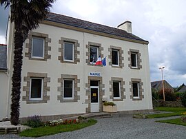 The town hall in Baye | ||
Location of Baye  | ||
(2020–2026) Pascal Bozec[1] | | |
| Area 1 | 7.29 km2 (2.81 sq mi) | |
| Population (2021)[2] | 1,325 | |
| • Density | 180/km2 (470/sq mi) | |
| Time zone | UTC+01:00 (CET) | |
| • Summer (DST) | UTC+02:00 (CEST) | |
| INSEE/Postal code | 29005 /29300 | |
| Elevation | 13–70 m (43–230 ft) | |
| 1 French Land Register data, which excludes lakes, ponds, glaciers > 1 km2 (0.386 sq mi or 247 acres) and river estuaries. | ||
Baye (French pronunciation: [bɛj]; Breton: Bei) is a commune in the Finistère department and administrative region of Brittany in north-western France.
Population
In French the inhabitants of Baye are known as Bayois.
Graphs are unavailable due to technical issues. There is more info on Phabricator and on MediaWiki.org. |
Geography
Baye is located in the southeast of Finistère, 4 km (2.5 mi) west of Quimperlé, 21.5 km (13.4 mi) northwest of Lorient and 40 km (25 mi) east of Quimper. Historically, Baye belongs to Cornouaille.
Map

Gallery
-
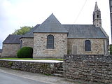 The parish church.
 -
 Mill in Baye.


See also
References
- ^ "Répertoire national des élus: les maires" (in French). data.gouv.fr, Plateforme ouverte des données publiques françaises. 13 September 2022.
- ^ "Populations légales 2021" (in French). The National Institute of Statistics and Economic Studies. 28 December 2023.
- ^ Des villages de Cassini aux communes d'aujourd'hui: Commune data sheet Baye, EHESS (in French).
- ^ Population en historique depuis 1968, INSEE
External links
Wikimedia Commons has media related to Baye (Finistère).
- Mayors of Finistère Association Archived 2021-03-18 at the Wayback Machine (in French);
- v
- t
- e

- Argol
- Arzano
- Audierne
- Bannalec
- Baye
- Bénodet
- Berrien
- Beuzec-Cap-Sizun
- Bodilis
- Bohars
- Bolazec
- Botmeur
- Botsorhel
- Bourg-Blanc
- Brasparts
- Brélès
- Brennilis
- Brestsubpr
- Briec
- Camaret-sur-Mer
- Carantec
- Carhaix-Plouguer
- Cast
- Châteaulinsubpr
- Châteauneuf-du-Faou
- Cléden-Cap-Sizun
- Cléden-Poher
- Cléder
- Clohars-Carnoët
- Clohars-Fouesnant
- Le Cloître-Pleyben
- Le Cloître-Saint-Thégonnec
- Coat-Méal
- Collorec
- Combrit
- Commana
- Concarneau
- Confort-Meilars
- Le Conquet
- Coray
- Crozon
- Daoulas
- Dinéault
- Dirinon
- Douarnenez
- Le Drennec
- Edern
- Elliant
- Ergué-Gabéric
- Le Faou
- La Feuillée
- Le Folgoët
- La Forest-Landerneau
- La Forêt-Fouesnant
- Fouesnant
- Garlan
- Gouesnac'h
- Gouesnou
- Gouézec
- Goulien
- Goulven
- Gourlizon
- Guengat
- Guerlesquin
- Guiclan
- Guilers
- Guiler-sur-Goyen
- Guilligomarc'h
- Guilvinec
- Guimaëc
- Guimiliau
- Guipavas
- Guissény
- Hanvec
- Henvic
- Hôpital-Camfrout
- Huelgoat
- Île de Batz
- Île de Sein
- Île-Tudy
- Irvillac
- Le Juch
- Kergloff
- Kerlaz
- Kerlouan
- Kernilis
- Kernouës
- Kersaint-Plabennec
- Lampaul-Guimiliau
- Lampaul-Plouarzel
- Lampaul-Ploudalmézeau
- Lanarvily
- Landéda
- Landeleau
- Landerneau
- Landévennec
- Landivisiau
- Landrévarzec
- Landudal
- Landudec
- Landunvez
- Langolen
- Lanhouarneau
- Lanildut
- Lanmeur
- Lannéanou
- Lannédern
- Lanneuffret
- Lannilis
- Lanrivoaré
- Lanvéoc
- Laz
- Lennon
- Lesneven
- Leuhan
- Loc-Brévalaire
- Loc-Eguiner
- Locmaria-Plouzané
- Locmélar
- Locquénolé
- Locquirec
- Locronan
- Loctudy
- Locunolé
- Logonna-Daoulas
- Lopérec
- Loperhet
- Loqueffret
- Lothey
- Mahalon
- La Martyre
- Melgven
- Mellac
- Mespaul
- Milizac-Guipronvel
- Moëlan-sur-Mer
- Molène
- Morlaixsubpr
- Motreff
- Névez
- Ouessant
- Pencran
- Penmarch
- Peumerit
- Plabennec
- Pleuven
- Pleyben
- Pleyber-Christ
- Plobannalec-Lesconil
- Ploéven
- Plogastel-Saint-Germain
- Plogoff
- Plogonnec
- Plomelin
- Plomeur
- Plomodiern
- Plonéis
- Plonéour-Lanvern
- Plonévez-du-Faou
- Plonévez-Porzay
- Plouarzel
- Ploudalmézeau
- Ploudaniel
- Ploudiry
- Plouédern
- Plouégat-Guérand
- Plouégat-Moysan
- Plouénan
- Plouescat
- Plouezoc'h
- Plougar
- Plougasnou
- Plougastel-Daoulas
- Plougonvelin
- Plougonven
- Plougoulm
- Plougourvest
- Plouguerneau
- Plouguin
- Plouhinec
- Plouider
- Plouigneau
- Ploumoguer
- Plounéour-Brignogan-Plages
- Plounéour-Ménez
- Plounéventer
- Plounévézel
- Plounévez-Lochrist
- Plourin
- Plourin-lès-Morlaix
- Plouvien
- Plouvorn
- Plouyé
- Plouzané
- Plouzévédé
- Plovan
- Plozévet
- Pluguffan
- Pont-Aven
- Pont-Croix
- Pont-de-Buis-lès-Quimerch
- Pont-l'Abbé
- Porspoder
- Port-Launay
- Pouldergat
- Pouldreuzic
- Poullan-sur-Mer
- Poullaouen
- Primelin
- Quéménéven
- Querrien
- Quimperpref
- Quimperlé
- Rédené
- Le Relecq-Kerhuon
- Riec-sur-Bélon
- La Roche-Maurice
- Roscanvel
- Roscoff
- Rosnoën
- Rosporden
- Saint-Coulitz
- Saint-Derrien
- Saint-Divy
- Saint-Eloy
- Sainte-Sève
- Saint-Évarzec
- Saint-Frégant
- Saint-Goazec
- Saint-Hernin
- Saint-Jean-du-Doigt
- Saint-Jean-Trolimon
- Saint-Martin-des-Champs
- Saint-Méen
- Saint-Nic
- Saint-Pabu
- Saint-Pol-de-Léon
- Saint-Renan
- Saint-Rivoal
- Saint-Sauveur
- Saint-Ségal
- Saint-Servais
- Saint-Thégonnec Loc-Eguiner
- Saint-Thois
- Saint-Thonan
- Saint-Thurien
- Saint-Urbain
- Saint-Vougay
- Saint-Yvi
- Santec
- Scaër
- Scrignac
- Sibiril
- Sizun
- Spézet
- Taulé
- Telgruc-sur-Mer
- Tourch
- Trébabu
- Treffiagat
- Tréflaouénan
- Tréflévénez
- Tréflez
- Trégarantec
- Trégarvan
- Tréglonou
- Trégourez
- Tréguennec
- Trégunc
- Le Tréhou
- Trémaouézan
- Tréméoc
- Tréméven
- Tréogat
- Tréouergat
- Le Trévoux
- Trézilidé
- pref: prefecture
- subpr: subprefecture
| Authority control databases: National |
|
|---|
 | This Finistère geographical article is a stub. You can help Wikipedia by expanding it. |
- v
- t
- e


