Blaine, Mississippi
Unincorporated community in Mississippi, United States
33°36′28″N 90°31′21″W / 33.60778°N 90.52250°W / 33.60778; -90.5225038778
Blaine is an unincorporated community located in central Sunflower County, Mississippi. Blaine is approximately 5 miles (8.0 km) north of Sunflower and 3 miles (4.8 km) south of Doddsville along U.S. Route 49W.
Gallery
-
 Blaine Community Church (on Bush Holeman Road)
 -
 Lighthouse C.O.G.I.C. (on Bush Holeman Road)
 -
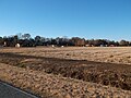 Homes in the community along the Sunflower River


References
- ^ U.S. Geological Survey Geographic Names Information System: Blaine, Mississippi
- v
- t
- e
Municipalities and communities of Sunflower County, Mississippi, United States
County seat: Indianola

communities
‡This populated place also has portions in an adjacent county or counties
- Mississippi portal
- United States portal
 | This Sunflower County, Mississippi state location article is a stub. You can help Wikipedia by expanding it. |
- v
- t
- e


