Bullock, North Carolina
Unincorporated community in North Carolina, United States
36°29′29″N 78°32′42″W / 36.49139°N 78.54500°W / 36.49139; -78.5450027507
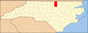
Bullock is an unincorporated community in Granville County, North Carolina, United States. The community is located on U.S. Route 15 3.3 miles (5.3 km) north-northeast of Stovall and 12.7 miles (20.4 km) north-northeast of Oxford. Bullock has a post office with ZIP code 27507.[2][3]
References
- ^ "Bullock". Geographic Names Information System. United States Geological Survey, United States Department of the Interior.
- ^ United States Postal Service (2012). "USPS - Look Up a ZIP Code". Retrieved February 8, 2015.
- ^ "Postmaster Finder - Post Offices by ZIP Code". United States Postal Service. Archived from the original on October 17, 2020. Retrieved February 8, 2015.
- v
- t
- e
Municipalities and communities of Granville County, North Carolina, United States
County seat: Oxford
communities
- North Carolina portal
- United States portal
This article about a location in Granville County, North Carolina is a stub. You can help Wikipedia by expanding it. |
- v
- t
- e


