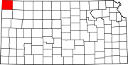
Calhoun Township, Cheyenne County, Kansas
Township in Kansas, United States
39°56′25″N 101°41′2″W / 39.94028°N 101.68389°W / 39.94028; -101.68389 (2000)
Calhoun Township is a township in Cheyenne County, Kansas, USA. As of the 2000 census, its population was 57. In 1898, the population was 253.[1]
History
A post office named Calhoun opened in 1886. The post office was discontinued in 1888.[2]
Geography
Calhoun Township covers an area of 89.87 square miles (232.8 km2) and contains no incorporated settlements. According to the USGS, it contains one cemetery, Barley.
Beaumaster Pond (historical) is within this township. The streams of Bluff Creek, Cleveland Run, Delay Creek, Hackberry Creek, Jones Canyon Creek, Nesbit Creek and Plum Creek run through this township.
References
- ^ Gannett, Henry (1898). A Gazetteer of Kansas. Bulletin. Vol. 154. United States Geological Survey. p. 47. OL 20596112M.
Calhoun; township in Cheyenne County; area, 54 square miles; population 253.
- ^ "Kansas Post Offices, 1828-1961". Kansas Historical Society. Retrieved January 5, 2018.
- USGS Geographic Names Information System (GNIS)
External links
- US-Counties.com
- City-Data.com
- v
- t
- e
Municipalities and communities of Cheyenne County, Kansas, United States
County seat: St. Francis
- Bird City
- St. Francis
communities
- Wheeler
- Kansas portal
- United States portal
 | This article about a location in Cheyenne County, Kansas is a stub. You can help Wikipedia by expanding it. |
- v
- t
- e


