Canjilón Mountain
Mountain in New Mexico, United States


Canjilón Mountain
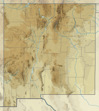
Location of Canjilón Mountain in New Mexico
Canjilón Mountain is a 10,922 feet (3,329 m). mountain approximately six miles northeast of the village of Canjilón,[3] in the Carson National Forest.
The word cajilon is the term for "deer antler" in Northern New Mexican Spanish.[4] The mountain was so named because of its resemblance to an antler.[4] The mountain gave its name to the nearby creek (Canjilon Creek), to the nearby lakes (Canjilon lakes), and to the village of Canjilon.[4]
Canjilón Mountain was the site of a 3.7 magnitude earthquake on June 4, 2008.[5]
References
- ^ a b "Jilon". NGS Data Sheet. National Geodetic Survey, National Oceanic and Atmospheric Administration, United States Department of Commerce. Retrieved 2014-02-12.
- ^ "Canjilon Mountain, New Mexico". Peakbagger.com. Retrieved 2014-02-12.
- ^ "Canjilón Lakes". Digital Abiquiu. Archived from the original on February 1, 2012. Retrieved February 12, 2014.
- ^ a b c Julyan, Robert (1998). The place names of New Mexico. Albuquerque, NM: University of New Mexico Press. ISBN 978-0826316899.
- ^ "Information on New Mexico Seismic Activity from the New Mexico Tech Seismological Observatory: Earthquake between Chama and Abiqui, NM". Department of Earth and Environmental Science, New Mexico Institute of Mining and Technology. Archived from the original on 27 September 2008.
- v
- t
- e
- Soldiers Farewell Hill
- Black Mountain (Catron County)
- McKnight Mountain
- Cerro Grande
- Chicoma Mountain
- Redondo Peak
- South Baldy
- Pyramid Peak
(Cibola County)
- Mount Taylor
- West Blue Mountain
| Manzano Mountains | |
|---|---|
| Sandia Mountains |
| Cimarron Range |
|
|---|---|
| Taos Mountains |
|
| Others |
|
- Haystack Mountain
- Mount Sedgwick
- Aden Crater
- Alamo Hueco Mountains
- Animas Mountains
- Brazos Mountains
- Caballo Mountains
- Canjilón Mountain
- Canyon Creek Mountains
- Capitan Mountains
- Capulin Peak
- Cedar Mountain Range
- Datil Mountains
- Dirty Point
- Doña Ana Mountains
- Eagle Peak
- East Potrillo Mountains
- Elephant Butte (Hidalgo County)
- Elephant Butte (Sierra County)
- Fajada Butte
- Florida Mountains
- Franklin Mountains
- Granite Peak
- Guadalupe Mountains
- Guadalupe Mountains (Hidalgo County)
- Hosta Butte
- Hueco Mountains
- Huérfano Mountain
- Jicarilla Mountains
- Jornada del Muerto Volcano
- Ladron Peak
- Little Burro Mountains
- Little Hatchet Mountains
- Little San Pascual Mountain
- Luera Mountains
- Sierra Nacimiento
- Ocate Peak
- Ortiz Mountains
- Picacho Mountain
- Robledo Mountains
- San Antonio Mountain
- San Mateo Mountains (Socorro County)
- Sierra Aguilada
- Sierra Blanca
- Sierra de las Uvas
- West Potrillo Mountains
 | This New Mexico state location article is a stub. You can help Wikipedia by expanding it. |
- v
- t
- e


