Cookville, Texas
Unincorporated community in Texas, United States
33°11′8″N 94°51′16″W / 33.18556°N 94.85444°W / 33.18556; -94.8544475558
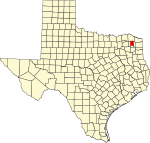
Cookville is an unincorporated community in eastern Titus County, Texas, United States. It lies along U.S. Route 67, east of the city of Mount Pleasant, the county seat of Titus County.[1] Its elevation is 433 feet (132 m).[2] Although Cookville is unincorporated, it has a post office, with the ZIP code of 75558, located at the junction of US 67 and Farm to Market Road 1000.[3]
References
- ^ Rand McNally. The Road Atlas '08. Chicago: Rand McNally, 2008, p. 100.
- ^ U.S. Geological Survey Geographic Names Information System: Cookville, Texas
- ^ Zip Code Lookup Archived 2011-06-15 at the Wayback Machine
External links
- U.S. Geological Survey Geographic Names Information System: Cookville, Texas
- v
- t
- e
Municipalities and communities of Titus County, Texas, United States
County seat: Mount Pleasant

communities
- Cookville
- Marshall Springs
- Texas portal
- United States portal
 | This article about a location in Titus County, Texas is a stub. You can help Wikipedia by expanding it. |
- v
- t
- e


