Dores de Campos
City in Southeast, Brazil

Flag
Seal
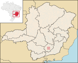
Localization in Minas Gerais
(2020 [1])
Dores de Campos is a Brazilian municipality. It is about 40 kilometers from São João del Rey at BR-265. About 30% of active people work in its principal factory: Marluvas.
As its neighbors cities, Dores de Campos is a point of Real Way (translated of Estrada Real).
It was founded in about 1720 and became a city on December 17, 1938.
Geography
According to IBGE (2017), the municipality is in the Immediate Geographic Region of Barbacena, in the Intermediate Geographic Region of Barbacena.[2]
Ecclesiastical circumscription
The municipality is part of the Roman Catholic Diocese of São João del-Rei.[3]
References
- v
- t
- e

Capital: Belo Horizonte
| |||||||

| |||||||||||||
| |||||||||
| |||||||
| |||||||||||||||||||||
| |||||||||||||||
| |||||||
| |||||||||||
| |||||||||||||||
| |||||||||
| |||||||
| |||||||||||||||||||||
21°06′S 44°02′W / 21.100°S 44.033°W / -21.100; -44.033
 | This geographical article relating to Minas Gerais is a stub. You can help Wikipedia by expanding it. |
- v
- t
- e


