East Stone Gap, Virginia
Census-designated place in Virginia, United States
36°52′00″N 82°44′33″W / 36.86667°N 82.74250°W / 36.86667; -82.74250 (2020)
24246
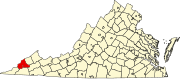
East Stone Gap is an unincorporated community and census-designated place in Wise County, Virginia, United States. East Stone Gap is an eastern suburb of Big Stone Gap; U.S. Route 23 separates the two settlements. It was first listed as a CDP in the 2020 census with a population of 537.[2] East Stone Gap has a post office with ZIP code 24246.[3][4]
References
- ^ "East Stone Gap". Geographic Names Information System. United States Geological Survey, United States Department of the Interior.
- ^ "East Stone Gap, Virginia". United States Census Bureau. Retrieved September 16, 2022.
- ^ United States Postal Service (2012). "USPS - Look Up a ZIP Code". Retrieved February 15, 2012.
- ^ "Postmaster Finder - Post Offices by ZIP Code". United States Postal Service. Archived from the original on October 17, 2020. Retrieved December 22, 2012.
- v
- t
- e
Municipalities and communities of Wise County, Virginia, United States
County seat: Wise
communities
‡This populated place also has portions in an adjacent county or counties
- Virginia portal
- United States portal
Authority control databases | |
|---|---|
| International |
|
| National |
|
 | This Wise County, Virginia state location article is a stub. You can help Wikipedia by expanding it. |
- v
- t
- e


