Freyberg Mountains
Mountains in Antarctica


Freyberg Mountains
The Freyberg Mountains (72°15′S 163°45′E / 72.250°S 163.750°E / -72.250; 163.750 (Freyberg Mountains)) are a group of mountains in Victoria Land, Antarctica, bounded by the Rennick Glacier, Bowers Mountains, Black Glacier, and Evans Névé.[1] They are west of the Victory Mountains and south of the Bowers Mountains.
Name
The Freyberg Mountains were named for New Zealand's most famous general, Bernard Freyberg, by the Northern Party of New Zealand Geological Survey Antarctic Expedition (NZGSAE), 1963–64.[1]
Location
Map all coordinates using OpenStreetMap
Download coordinates as:
- KML
- GPX (all coordinates)
- GPX (primary coordinates)
- GPX (secondary coordinates)

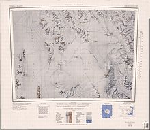
The Freyberg Mountains lie to the east of the Rennick Glacier and to the south of the Bowers Mountains. The Canham Glacier defines their northwest limit. The Black Glacier defines their eastern limit, separating them from the Leitch Massif, Neall Massif and West Quartzite Range further east. They extend south to the Evans Névé.[2][3]
Mountains
| Name | Coordinates | Height |
|---|---|---|
| Mount Baldwin | 72°15′S 163°18′E / 72.250°S 163.300°E / -72.250; 163.300 (Mount Baldwin) | |
| Buttress Peak | 72°26′S 163°45′E / 72.433°S 163.750°E / -72.433; 163.750 (Buttress Peak) | |
| Mount Jackman | 72°24′S 163°15′E / 72.400°S 163.250°E / -72.400; 163.250 (Mount Jackman) | 1,920 metres (6,300 ft) |
| Mount Strandtmann | 72°7′S 163°5′E / 72.117°S 163.083°E / -72.117; 163.083 (Mount Strandtmann) | |
| Mount Massell | 72°29′S 163°21′E / 72.483°S 163.350°E / -72.483; 163.350 (Mount Massell) | 1,880 metres (6,170 ft) |
Ranges
Geographical divisions of Freyberg Mountains include:
- Alamein Range 72°5′S 163°30′E / 72.083°S 163.500°E / -72.083; 163.500 (Alamein Range), a range lying west of Canham Glacier.[4]
- Salamander Range 72°6′S 164°8′E / 72.100°S 164.133°E / -72.100; 164.133 (Salamander Range), a distinctive linear range between Canham Glacier and Black Glacier.[5]
- Gallipoli Heights 72°26′S 163°48′E / 72.433°S 163.800°E / -72.433; 163.800 (Gallipoli Heights), a group of peaks and ridges centered 7.5 nautical miles (13.9 km; 8.6 mi) south-southeast of Monte Cassino.[6]
References
- ^ a b Alberts 1995, p. 260.
- ^ Freyberg Mountains USGS.
- ^ Mount Soza USGS.
- ^ Alberts 1995, p. 8.
- ^ Alberts 1995, pp. 643–644.
- ^ Alberts 1995, p. 266.
Sources
- Alberts, Fred G., ed. (1995), Geographic Names of the Antarctic (PDF) (2 ed.), United States Board on Geographic Names, retrieved 2024-01-30
 This article incorporates public domain material from websites or documents of the United States Board on Geographic Names.
 - Freyberg Mountains, USGS: United States Geographic Board, retrieved 2024-03-04
- Mount Soza, USGS: United States Geographic Board, retrieved 2024-02-04
![]() This article incorporates public domain material from websites or documents of the United States Geological Survey.
This article incorporates public domain material from websites or documents of the United States Geological Survey.


