Göynücek District
District of Amasya Province, Turkey
District in Amasya, Turkey
40°23′N 35°31′E / 40.383°N 35.517°E / 40.383; 35.517 (2021)
Göynücek District is a district of Amasya Province of Turkey. Its seat is the town Göynücek.[1] Its area is 591 km2,[2] and its population is 10,291 (2021).[3] It borders the provinces of Tokat, Çorum and Yozgat.
Composition
There is one municipality in Göynücek District:[1]
There are 38 villages in Göynücek District:[4]
- Abacı
- Alan
- Ardıçpınar
- Asar
- Ayvalıpınar
- Başpınar
- Bekdemir
- Beşiktepe
- Çamurlu
- Çayan
- Çaykışla
- Çulpara
- Damlaçimen
- Davutevi
- Gaffarlı
- Gediksaray
- Gökçeli
- Harmancık
- Hasanbey
- İkizyaka
- Ilısu
- Karaşar
- Karayakup
- Kertme
- Kervansaray
- Kışlabeyi
- Konuralan
- Koyuncu
- Kuyulu Kavaklı
- Pembeli
- Şarklı
- Şeyhler
- Şeyhoğlu
- Sığırçayı
- Tencerli
- Terziköy
- Yassıkışla
- Yeniköy
Places of interest
- The Roman castle of Gökçeli on a rock overlooking the valley, 8 km from the town Göynücek. It is reached by a hidden path of 98 steps.
- The mineral waters of the village of Çamurlu, said to relieve kidney stones.
References
- ^ a b İlçe Belediyesi, Turkey Civil Administration Departments Inventory. Retrieved 12 January 2023.
- ^ "İl ve İlçe Yüz ölçümleri". General Directorate of Mapping. Retrieved 12 January 2023.
- ^ "Address-based population registration system (ADNKS) results dated 31 December 2021" (XLS) (in Turkish). TÜİK. Retrieved 12 January 2023.
- ^ Köy, Turkey Civil Administration Departments Inventory. Retrieved 15 January 2023.
- v
- t
- e
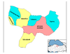
Göynücek District in Amasya Province of Turkey

| Istanbul | |
|---|---|
| West Marmara | |
| Aegean | |
| East Marmara | |
| West Anatolia | |
| Mediterranean | |
| Central Anatolia | |
| West Black Sea | |
| East Black Sea | |
| Northeast Anatolia | |
| Central East Anatolia | |
| Southeast Anatolia | |
Metropolitan municipalities are bolded.
 Göynücek District Göynücek District | |
|---|---|
| Municipalities | |
| Villages |
|
 | This geographical article about a location in Amasya Province, Turkey is a stub. You can help Wikipedia by expanding it. |
- v
- t
- e


