Gulf Plains
Region in Australia
| Gulf Plains Australia | |||||||||||||||
|---|---|---|---|---|---|---|---|---|---|---|---|---|---|---|---|
 The interim Australian bioregions, with Gulf Plains in red | |||||||||||||||
| Area | 220,418.25 km2 (85,104.0 sq mi) | ||||||||||||||
| |||||||||||||||
The Gulf Plains, an interim Australian bioregion (IBRA), is located in the Northern Territory and Queensland, comprising 22,041,825 hectares (54,466,540 acres).[1] It is one of 89 such bioregions defined in Australia, with 419 subregions as of IBRA version 7, compared with the 85 bioregions and 403 subregions described in IBRA6.1.[2][3]
The code for the bioregion is GUP.[1]
| IBRA regions and subregions: IBRA7 | ||||
|---|---|---|---|---|
| IBRA region / subregion | IBRA code | Area | States | Location in Australia |
| Gulf Plains | GUP | 22,041,825 hectares (54,466,540 acres) | NT / Qld | 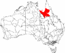 |
| Karumba Plains | GUP01 | 1,057,366 hectares (2,612,810 acres) | ||
| Armraynald Plains | GUP02 | 1,589,437 hectares (3,927,580 acres) | ||
| Woondoola Plains | GUP03 | 2,375,110 hectares (5,869,000 acres) | ||
| Mitchell-Gilbert Fans | GUP04 | 5,262,816 hectares (13,004,700 acres) | ||
| Claraville Plains | GUP05 | 3,738,013 hectares (9,236,830 acres) | ||
| Holroyd Plain-Red Plateau | GUP06 | 2,208,468 hectares (5,457,240 acres) | ||
| Doomadgee Plains | GUP07 | 1,831,823 hectares (4,526,530 acres) | ||
| Donors Plateau | GUP08 | 2,449,964 hectares (6,053,990 acres) | ||
| Gilberton Plateau | GUP09 | 1,403,937 hectares (3,469,200 acres) | ||
| Wellesley Islands | GUP10 | 124,893 hectares (308,620 acres) | ||
See also
 Queensland portal
 Environment portal


- Geography of Australia
References
- ^ a b "Interim Biogeographic Regionalisation for Australia (IBRA7) regions and codes". Department of Sustainability, Environment, Water, Population and Communities. Commonwealth of Australia. 2012. Retrieved 13 January 2013.
- ^ "Australia's bioregions (IBRA)". Department of Agriculture, Water and the Environment. Australian Government. Retrieved 27 February 2022.
- ^ Stanton, J. P. (James Peter); Morgan, M. G; University of New England. School of Natural Resources (1977), The rapid selection and appraisal of key and endangered sites : the Queensland case study, the University of New England School of Natural Resources, p. 3, retrieved 11 February 2022
Further reading
- Thackway, R and I D Cresswell (1995) An interim biogeographic regionalisation for Australia : a framework for setting priorities in the National Reserves System Cooperative Program Version 4.0 Canberra : Australian Nature Conservation Agency, Reserve Systems Unit, 1995. ISBN 0-642-21371-2
- v
- t
- e
- Arnhem Coast
- Arnhem Plateau
- Australian Alps
- Avon Wheatbelt
- Ben Lomond
- Brigalow Belt North
- Brigalow Belt South
- Broken Hill Complex
- Burt Plain
- Cape York Peninsula
- Carnarvon
- Central Arnhem
- Central Kimberley
- Central Mackay Coast
- Central Ranges
- Channel Country
- Cobar Peneplain
- Coolgardie
- Coral Sea
- Cumberland Plain
- Daly Basin
- Dampierland
- Darling Riverine Plains
- Darwin Coastal
- Davenport Murchison Ranges
- Desert Uplands
- Einasleigh Uplands
- Esperance Plains
- Eyre Yorke Block
- Finke
- Flinders Lofty Block
- Furneaux
- Gascoyne
- Gawler
- Geraldton Sandplains
- Gibson Desert
- Great Sandy Desert
- Great Victoria Desert
- Gulf Coastal
- Gulf Fall and Uplands
- Gulf Plains
- Hampton
- Indian Tropical Islands
- Jarrah Forest
- Kanmantoo
- King
- Little Sandy Desert
- MacDonnell Ranges
- Mallee
- Mitchell Grass Downs
- Mount Isa Inlier
- Mulga Lands
- Murchison
- Murray Darling Depression
- Nandewar
- Naracoorte Coastal Plain
- New England Tablelands
- Northern Kimberley
- New South Wales North Coast
- New South Wales South Western Slopes
- Nullarbor Plain
- Ord Victoria Plain
- Pacific Subtropical Islands
- Pine Creek
- Pilbara
- Riverina
- Simpson Strzelecki Dunefields
- South East Coastal Plain
- South East Corner
- South Eastern Highlands
- South Eastern Queensland
- Southern Volcanic Plain
- Stony Plains
- Sturt Plateau
- Subantarctic Islands
- Swan Coastal Plain
- Sydney Basin
- Tanami
- Tasmanian Central Highlands
- Tasmanian Northern Midlands
- Tasmanian Northern Slopes
- Tasmanian South East
- Tasmanian Southern Ranges
- Tasmanian West
- Tiwi Cobourg
- Victoria Bonaparte
- Victorian Midlands
- Warren
- Wet Tropics
- Yalgoo
| ||
|---|---|---|
| Topics |  | |
| Regions | ||
| Major settlements | ||
| |||||
|---|---|---|---|---|---|
| General |  | ||||
| Politics and Government |
| ||||
| Regions | |||||
| Cities and towns | |||||
| People |
| ||||
| |||||

 | This Northern Territory geography article is a stub. You can help Wikipedia by expanding it. |
- v
- t
- e
 | This Queensland location article is a stub. You can help Wikipedia by expanding it. |
- v
- t
- e


