Hammel and Millgrove, Ohio
Extinct towns in Ohio, U.S.
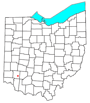
Hammel and Millgrove are extinct towns in western Warren County, Ohio, United States. They are located along the Little Miami River, about 2 miles (3 km) south of Fort Ancient and 1 mile (1½ km) north of Roachester at the Strout Road crossing of the river. Hammel lies on the eastern shore of the river, in southwestern Washington Township, and Millgrove lies on the western shore of the river, in northeastern Salem Township.
Hammel had its start in the 1840s when the railroad was extended to that point.[1] The community was named after its founder.[1] The GNIS considers Hammel to be a ghost town.[2]
References
- ^ a b The History of Warren County, Ohio: Containing a History of the County ; Its Townships, Towns ; General and Local Statistics. W.H. Beers & Company. 1882. p. 709.
- ^ U.S. Geological Survey Geographic Names Information System: Hammel (historical)
- v
- t
- e
Municipalities and communities of Warren County, Ohio, United States
County seat: Lebanon
- Carlisle‡
- Franklin
- Lebanon
- South Lebanon
- Loveland‡
- Mason
- Middletown‡
- Monroe‡
- Springboro‡

communities
- Blackhawk
- Chautauqua‡
- Cozaddale
- Crosswick
- Dallasburg
- Dodds
- Edwardsville
- Fosters
- Genntown
- Greentree Corners
- Gum Grove
- Hagemans Crossing
- Hickoryville
- Hicks
- Hillcrest
- Hopkinsville
- Kenricksville
- Level
- Mathers Mill
- Merrittstown
- Middleboro
- Mount Holly
- Murdoch
- Oregonia
- Osceola
- Pekin
- Red Lion
- Ridgeville
- Rossburg
- San Mar Gale
- Socialville
- Twenty Mile Stand
- Wellman
- Zoar
- Beedles Station
- Browns Store
- Butterworth
- Hammel and Millgrove
- Venable
‡This populated place also has portions in an adjacent county or counties
- Ohio portal
- United States portal
39°23′09″N 84°05′22″W / 39.38583°N 84.08944°W / 39.38583; -84.08944
 | This Warren County, Ohio state location article is a stub. You can help Wikipedia by expanding it. |
- v
- t
- e


