Hayrat
District and municipality in Trabzon, Turkey
40°53′21″N 40°22′04″E / 40.88917°N 40.36778°E / 40.88917; 40.36778 (2022)[1]
61450
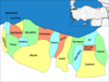
Hayrat is a municipality and district of Trabzon Province, Turkey.[2] Its area is 244 km2,[3] and its population is 7,667 (2022).[1] The mayor is Mehmet Nuhoğlu (AKP).
History
During World War I, occupied by the Russians, Hayrat was freed from the occupation on 28 February 1918.
Composition
There are 35 neighbourhoods in Hayrat District:[4]
- Ağaçlı Düz
- Balaban
- Balaban Merkez
- Çağlayan
- Çamlıtepe
- Çaycılar
- Cumhuriyet
- Dağönü
- Dereyurt
- Fatih
- Geçitli
- Göksel
- Görgülü
- Gülderen Fatih
- Gülderen Merkez
- Hamzalı
- Hürriyet
- Kılavuz
- Köyceğiz
- Kurtuluş
- Merkez
- Meydanlı
- Onurlu
- Pazarönü
- Pınarca
- Sarmaşık
- Şehitli
- Şişli
- Taflancık
- Topaklı
- Yarlı
- Yeniköy
- Yenimahalle
- Yıldırımlar
- Yırca
References
- ^ a b "Address-based population registration system (ADNKS) results dated 31 December 2022, Favorite Reports" (XLS). TÜİK. Retrieved 19 September 2023.
- ^ Büyükşehir İlçe Belediyesi, Turkey Civil Administration Departments Inventory. Retrieved 19 September 2023.
- ^ "İl ve İlçe Yüz ölçümleri". General Directorate of Mapping. Retrieved 19 September 2023.
- ^ Mahalle, Turkey Civil Administration Departments Inventory. Retrieved 19 September 2023.
External links
- District governor's official website (in Turkish)
- v
- t
- e
Hayrat in Trabzon Province of Turkey

| Istanbul | |
|---|---|
| West Marmara | |
| Aegean | |
| East Marmara | |
| West Anatolia | |
| Mediterranean | |
| Central Anatolia | |
| West Black Sea | |
| East Black Sea | |
| Northeast Anatolia | |
| Central East Anatolia | |
| Southeast Anatolia | |
Metropolitan municipalities are bolded.
 | This article about a Black Sea Region of Turkey location is a stub. You can help Wikipedia by expanding it. |
- v
- t
- e


