Hillside Colony, South Dakota
Census-designated place in South Dakota, United States
44°44′18″N 98°02′50″W / 44.73833°N 98.04722°W / 44.73833; -98.04722[1]
[2]
(2020)[3]
57436 (Doland)
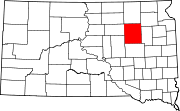
Hillside Colony is a census-designated place (CDP) and Hutterite colony[4] in Spink County, South Dakota, United States. It was first listed as a CDP prior to the 2020 census.[2] The population of the CDP was 123 at the 2020 census.[5]
It is in the southeast part of the county, bordered to the southeast by Foster Creek, a southwest-flowing tributary of the James River. It is 13 miles (21 km) by road south-southeast of Doland and 24 miles (39 km) southeast of Frankfort.
Demographics
| Census | Pop. | Note | %± |
|---|---|---|---|
| 2020 | 123 | — | |
| U.S. Decennial Census[6] | |||
References
- ^ "ArcGIS REST Services Directory". United States Census Bureau. Retrieved October 15, 2022.
- ^ a b c U.S. Geological Survey Geographic Names Information System: Hillside Colony, South Dakota
- ^ "Census Population API". United States Census Bureau. Retrieved October 15, 2022.
- ^ Friesen, Bert (May 2021). "Hillside Hutterite Colony (Doland, South Dakota, USA)". Global Anabaptist Mennonite Encyclopedia Online. Retrieved September 20, 2021.
- ^ "U.S. Census Bureau: Hillside Colony CDP, South Dakota". www.census.gov. United States Census Bureau. Retrieved February 12, 2022.
- ^ "Census of Population and Housing". Census.gov. Retrieved June 4, 2016.
- v
- t
- e
Municipalities and communities of Spink County, South Dakota, United States
County seat: Redfield
- Antelope
- Athol
- Belle Plaine
- Belmont
- Benton
- Beotia
- Buffalo
- Capitola
- Clifton
- Conde
- Cornwall
- Crandon
- Exline
- Frankfort
- Garfield
- Great Bend
- Groveland
- Harmony
- Harrison
- Jefferson
- Lake
- La Prairie
- Lincoln
- Lodi
- Mellette
- Northville
- Olean
- Prairie Center
- Redfield
- Richfield
- Spring
- Summer
- Tetonka
- Three Rivers
- Tulare
- Turton
- Union
- Camrose Colony
- Clark Colony
- Glendale Colony
- Hillside Colony
- Mansfield‡
- Spink Colony
communities
‡This populated place also has portions in an adjacent county or counties
- South Dakota portal
- United States portal
 | This South Dakota state location article is a stub. You can help Wikipedia by expanding it. |
- v
- t
- e


