Municipality in Southeast, Brazil

Flag

Seal
| Nickname: Encanto do Planalto |
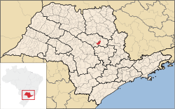 Location of Ibaté |
| Coordinates: 21°57′18″S 47°59′49″W / 21.95500°S 47.99694°W / -21.95500; -47.99694 |
| Country |  Brazil Brazil |
|---|
| Region | Southeast |
|---|
| State |  São Paulo São Paulo |
|---|
| Mesoregion | Araraquara |
|---|
| Government |
|---|
| • Mayor | José Luiz Parella |
|---|
| Area |
|---|
| • Total | 289.544 km2 (111.794 sq mi) |
|---|
| Elevation | 839 m (2,753 ft) |
|---|
| Population (2020 [1]) |
|---|
| • Total | 35,472 |
|---|
| • Density | 105.74/km2 (273.9/sq mi) |
|---|
| Time zone | UTC−3 (BRT) |
|---|
| Postal Code | 14815-000 |
|---|
| Area code | +55 16 |
|---|
| Website | Prefecture of Ibaté, SP |
|---|
Ibaté is a municipality in the state of São Paulo, Brazil with a population of 35,472 in 2020 according to IBGE. The city's name comes from the Tupi language and means "dry lake".[2]
Ibaté is located on the east-center of the state, 12 km from São Carlos and 247 km from the city of São Paulo.
History
The origins and development of the city has relation with the coffee production on the region, at the end of the 19th century. The village of São João Batista da Lagoa was founded on January 29, 1893. In 1900 the village was elevated to district, with the name of Vila de Ibaté.
On December 30, 1953, Ibaté was officially established as a municipality.[2]
In telecommunications, the city was served by Companhia Telefônica Brasileira until 1973, when it began to be served by Telecomunicações de São Paulo.[3] In July 1998, this company was acquired by Telefónica, which adopted the Vivo brand in 2012.[4]
The company is currently an operator of cell phones, fixed lines, internet (fiber optics/4G) and television (satellite and cable).[4]
References
- ^ IBGE 2020
- ^ a b "History of the City on the Prefecture's site" (in Portuguese). Ibate.sp.gov.br. Retrieved 23 Jul 2011.
- ^ "Creation of Telesp - April 12, 1973". www.imprensaoficial.com.br (in Portuguese). Retrieved 2024-05-27.
- ^ a b "Our History - Telefônica RI". Telefônica. Retrieved 2024-05-27.
State of São Paulo, Brazil
|
|
|
|---|
| Capital | |
|---|
| 1,000,000+ | |
|---|
| 500,000+ | |
|---|
| 200,000+ | |
|---|
| 100,000+ | |
|---|
|
|
|
|
|---|
|
Araçatuba |
|---|
| Andradina | |
|---|
| Araçatuba | |
|---|
| Birigui | |
|---|
|
| |
|
|
Bauru |
|---|
| Avaré | |
|---|
| Bauru | |
|---|
| Botucatu | |
|---|
| Jaú | |
|---|
| Lins | |
|---|
|
|
Campinas |
|---|
| Amparo | |
|---|
| Campinas | |
|---|
| Mogi Mirim | |
|---|
| Pirassununga | |
|---|
| São João da Boa Vista | |
|---|
|
|
Itapetininga |
|---|
| Capão Bonito | |
|---|
| Itapetininga | |
|---|
| Itapeva | |
|---|
| Tatuí | |
|---|
|
|
|
Macro Metropolitana Paulista |
|---|
| Bragança Paulista | |
|---|
| Jundiaí | |
|---|
| Piedade | |
|---|
| Sorocaba | |
|---|
|
|
|
Metropolitana de São Paulo |
|---|
| Franco da Rocha | |
|---|
| Guarulhos | |
|---|
| Itapecerica da Serra | |
|---|
| Mogi das Cruzes | |
|---|
| Osasco | |
|---|
| Santos | |
|---|
| São Paulo | |
|---|
|
|
Piracicaba |
|---|
| Limeira | |
|---|
| Piracicaba | |
|---|
| Rio Claro | |
|---|
|
|
Presidente Prudente |
|---|
| Adamantina | |
|---|
| Dracena | |
|---|
| Presidente Prudente | |
|---|
|
|
Ribeirão Preto |
|---|
| Barretos | |
|---|
| Batatais | |
|---|
| Franca | |
|---|
| Ituverava | |
|---|
| Jaboticabal | |
|---|
| Ribeirão Preto | |
|---|
| São Joaquim da Barra | |
|---|
|
|
São José do Rio Preto |
|---|
| Auriflama | |
|---|
| Catanduva | |
|---|
| Fernandópolis | |
|---|
| Jales | |
|---|
| Nhandeara | |
|---|
| Novo Horizonte | |
|---|
| São José do Rio Preto | |
|---|
| Votuporanga | |
|---|
|
|
Vale do Paraíba Paulista |
|---|
| Bananal | |
|---|
| Campos do Jordão | |
|---|
| Caraguatatuba | |
|---|
| Guaratinguetá | |
|---|
| Paraibuna/Paraitinga | |
|---|
| São José dos Campos | |
|---|
|
|
 | This geographical article relating to the state of São Paulo is a stub. You can help Wikipedia by expanding it. |


 Brazil
 São Paulo


