Kınık
District and municipality in İzmir, Turkey
39°05′38″N 27°22′36″E / 39.09389°N 27.37667°E / 39.09389; 27.37667 (2022)[1]
35990
Kınık (Turkish: [ˈkɯnɯk]) is a municipality and district of İzmir Province, Turkey.[2] Its area is 479 km2,[3] and its population is 28,694 (2022).[1]
Composition
There are 37 neighbourhoods in Kınık District:[4]
- Arpadere
- Arpaseki
- Aşağı
- Aziziye
- Bademalanı
- Bağalanı
- Balaban
- Büyükoba
- Çaltı
- Çanköy
- Çiftlikköy
- Cumalı
- Değirmencieli
- Dündarlı
- Elmadere
- Fatih
- Hamzahocalı
- İbrahimağa
- Işıklar
- Kalemköy
- Karadere
- Karatekeli
- Kocaömerli
- Kodukburun
- Köseler
- Mıstıklar
- Musacalı
- Örtülü
- Osmaniye
- Poyracık
- Sucahlı
- Taştepe
- Türk
- Yayakent
- Yaylaköy
- Yeni
- Yukarı
References
- ^ a b "Address-based population registration system (ADNKS) results dated 31 December 2022, Favorite Reports" (XLS). TÜİK. Retrieved 12 July 2023.
- ^ Büyükşehir İlçe Belediyesi, Turkey Civil Administration Departments Inventory. Retrieved 12 July 2023.
- ^ "İl ve İlçe Yüz ölçümleri". General Directorate of Mapping. Retrieved 12 July 2023.
- ^ Mahalle, Turkey Civil Administration Departments Inventory. Retrieved 12 July 2023.
- v
- t
- e
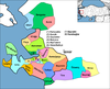
Kınık in Izmir Province of Turkey

| Istanbul | |
|---|---|
| West Marmara | |
| Aegean | |
| East Marmara | |
| West Anatolia | |
| Mediterranean | |
| Central Anatolia | |
| West Black Sea | |
| East Black Sea | |
| Northeast Anatolia | |
| Central East Anatolia | |
| Southeast Anatolia | |
Metropolitan municipalities are bolded.
Authority control databases | |
|---|---|
| International |
|
| National |
|
| Other |
|
 | This geographical article about a location in İzmir Province, Turkey is a stub. You can help Wikipedia by expanding it. |
- v
- t
- e


