Kamenný Most (Nové Zámky District)
Village in Slovakia
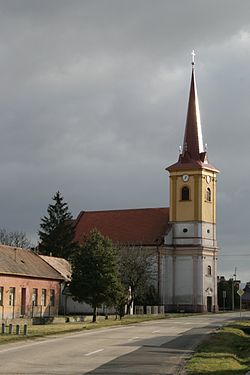
Kamenný Most Kőhídgyarmat | |
|---|---|
village | |
 | |
47°51′12″N 18°39′15″E / 47.85333°N 18.65417°E / 47.85333; 18.65417 | |
| Country |  Slovakia Slovakia |
| Region |  Nitra Region Nitra Region |
| District | Nové Zámky District |
| Founded | 1271 |
| Government | |
| • Mayor | Katalin Heiszler |
| Area [1] | |
| • Total | 20.33 km2 (7.85 sq mi) |
| Elevation [2] | 112 m (367 ft) |
| Population (2021)[3] | |
| • Total | 1,030 |
| • Density | 51/km2 (130/sq mi) |
| Time zone | UTC+1 (CET) |
| • Summer (DST) | UTC+2 (CEST) |
| Postal code | 943 58[2] |
| Area code | +421 36[2] |
| Car plate | NZ |
| Website | http://www.parkany.sk/kamennymost |
Kamenný Most (Hungarian: Kőhídgyarmat) is a village and municipality in the Nové Zámky District in the Nitra Region of south-west Slovakia.
Geography
The village lies at an altitude of 114 metres and covers an area of 20.336 km².
History
In historical records the village was first mentioned in 1271 After the Austro-Hungarian army disintegrated in November 1918, Czechoslovak troops occupied the area, later acknowledged internationally by the Treaty of Trianon. Between 1938 and 1945 Kamenný Most once more became part of Miklós Horthy's Hungary through the First Vienna Award. From 1945 until the Velvet Divorce, it was part of Czechoslovakia. Since then it has been part of Slovakia.
Population
On 31 December 2011, it had a population of 1054 people.[4]
Facilities
The village has a public library and a football pitch.
See also
References
- ^ "Hustota obyvateľstva - obce [om7014rr_ukaz: Rozloha (Štvorcový meter)]". www.statistics.sk (in Slovak). Statistical Office of the Slovak Republic. 2022-03-31. Retrieved 2022-03-31.
- ^ a b c "Základná charakteristika". www.statistics.sk (in Slovak). Statistical Office of the Slovak Republic. 2015-04-17. Retrieved 2022-03-31.
- ^ "Počet obyvateľov podľa pohlavia - obce (ročne)". www.statistics.sk (in Slovak). Statistical Office of the Slovak Republic. 2022-03-31. Retrieved 2022-03-31.
- ^ "Archived copy". Archived from the original on 2013-09-21. Retrieved 2013-10-02.
{{cite web}}: CS1 maint: archived copy as title (link) Štatistický úrad Slovenskej republiky – 31. december 2011 (ZIP 128,1 kB)
Genealogical resources
The records for genealogical research are available at the state archive "Statny Archiv in Nitra, Slovakia"
- Roman Catholic church records (births/marriages/deaths): 1720-1895 (parish A)
External links
- https://web.archive.org/web/20070513023228/http://www.statistics.sk/mosmis/eng/run.html
- Kamenný Most – Nové Zámky Okolie
- Surnames of living people in Kamenny Most
- v
- t
- e
Municipalities of Nové Zámky District
- Andovce
- Bajtava
- Bánov
- Bardoňovo
- Belá
- Bešeňov
- Bíňa
- Branovo
- Bruty
- Čechy
- Černík
- Dedinka
- Dolný Ohaj
- Dubník
- Dvory nad Žitavou
- Gbelce
- Hul
- Chľaba
- Jasová
- Jatov
- Kamenica nad Hronom
- Kamenín
- Kamenný Most
- Kmeťovo
- Kolta
- Komjatice
- Komoča
- Leľa
- Lipová
- Ľubá
- Malá nad Hronom
- Malé Kosihy
- Maňa
- Michal nad Žitavou
- Mojzesovo
- Mužla
- Nána
- Nová Vieska
- Obid
- Palárikovo
- Pavlová
- Podhájska
- Pozba
- Radava
- Rastislavice
- Rúbaň
- Salka
- Semerovo
- Sikenička
- Strekov
- Svodín
- Šarkan
- Trávnica
- Tvrdošovce
- Úľany nad Žitavou
- Veľké Lovce
- Veľký Kýr
- Vlkas
- Zemné

| Authority control databases: National |
|
|---|
 | This Nitra Region geography article is a stub. You can help Wikipedia by expanding it. |
- v
- t
- e


