Karub, Qamdo
District in Tibet, China
Karub District 32°16′34″N 97°15′41″E / 32.27611°N 97.26139°E / 32.27611; 97.26139 | |
|---|---|
| Country | China |
| Autonomous region | Tibet |
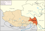
| Prefecture-level city | Chamdo |
| District seat | Chengguan |
| Area | |
| • Total | 10,793.22 km2 (4,167.29 sq mi) |
| Population (2020)[1] | |
| • Total | 148,511 |
| • Density | 14/km2 (36/sq mi) |
| Time zone | UTC+8 (China Standard) |
| Website | karuo |
| Karub, Qamdo | |||||||||||
|---|---|---|---|---|---|---|---|---|---|---|---|
| Chinese name | |||||||||||
| Simplified Chinese | 卡若区 | ||||||||||
| Traditional Chinese | 卡若區 | ||||||||||
| |||||||||||
| Tibetan name | |||||||||||
| Tibetan | མཁར་རོ་ཆུས། | ||||||||||
| |||||||||||
Karub District[2] also known as Kharro or Karuo, is a district in Qamdo, in the Tibet Autonomous Region of China, and the seat of government of Qamdo. Karuo has an area of 10,700 km2 and a population of 78,000, of which 90% are Tibetan. The average temperature is 7.6 °C, with average temperatures of −2.3 °C in January and 16.3 °C in July. The average precipitation is 467 mm per year.[citation needed]
Popular with tourists are the Galden Jampaling Monastery in the capital and the salt mines and hot springs at Yangjing.[citation needed]
Administrative divisions


Karub administers 3 towns and 12 townships.
| Name | Chinese | Hanyu Pinyin | Tibetan | Wylie | Population (2010)[3] | Area (km2) |
|---|---|---|---|---|---|---|
| Towns | ||||||
| Chengguan Town | 城关镇 | Chéngguān Zhèn | ཁྲིན་ཀོན་གྲོང་རྡལ | khrin kon grong rdal | 2 | 195.39 |
| Guro Town | 俄洛镇 | Éluò Zhèn | འགུ་རོ་གྲོང་རྡལ | agu ro grong rdal | 9 | 776.74 |
| Karuo Town | 卡若镇 | Kǎruò Zhèn | མཁར་རོ་གྲོང་རྡལ | mkhar ro grong rdal | 11 | 649.42 |
| Townships | ||||||
| Mongda Township | 芒达乡 | Mángdá Xiāng | རྨོ་མདའ་ཤང | rmo mda' shang | 8 | 440.24 |
| Sagang Township | 沙贡乡 | Shāgòng Xiāng | ས་རྒང་ཤང | sa rgang shang | 42 | 589.70 |
| Ormaika Township | 若巴乡 | Ruòbā Xiāng | ཨོར་སྨད་ཁ་ཤང | or smad kha shang | 1 | 897.33 |
| Ngêxi Township | 埃西乡 | Āixī Xiāng | རྔེ་གཤེས་ཤང | rnge gshes shang | 18 | 422.93 |
| Ruxi Township | 如意乡 | Rúyì Xiāng | རུ་བཞི་ཤང | ru bzhi shang | 4 | 329.80 |
| Retong Township | 日通乡 | Rìtōng Xiāng | རེ་ཐོང་ཤང | re thong shang | 0 | 546.76 |
| Cêrwai Township | 柴维乡 | Cháiwéi Xiāng | ཚེར་དབད་ཤང | tsher dbad shang | –6 | 946.19 |
| Toba Township | 妥坝乡 | Tuǒbà Xiāng | ཐོ་པ་ཤང | tho ba shang | 3 | 1,769.10 |
| Karma Township | 嘎玛乡 | Gāmǎ Xiāng | ཀ་རྨ་ཤང | ka rma shang | 7 | 498.93 |
| Mainda Township | 面达乡 | Miàndá Xiāng | སྨན་མདའ་ཤང | sman mda' shang | 2.5 | 1,085.23 |
| Yorba Township | 约巴乡 | Yuēbā Xiāng | ཡོར་པ་ཤང | yor pa shang | 6 | 486.81 |
| Latog Township | 拉多乡 | Lāduō Xiāng | ལྷ་ཐོག་ཤང | lha thog shang | 13 | 1,728.35 |
See also
 China portal
 Asia portal


References
- ^ "昌都市第七次全国人口普查主要数据公报" (in Chinese). Government of Chamdo. 2021-06-22.
- ^ "Aerial view of Karub District in Qamdo, Tibet". Xinhua News Agency. 2021-02-18.
- ^ shi, Guo wu yuan ren kou pu cha ban gong; council, Guo jia tong ji ju ren kou he jiu ye tong ji si bian = Tabulation on the 2010 population census of the people's republic of China by township / compiled by Population census office under the state; population, Department of; statistics, employment statistics national bureau of (2012). Zhongguo 2010 nian ren kou pu cha fen xiang, zhen, jie dao zi liao (Di 1 ban. ed.). Beijing Shi: Zhongguo tong ji chu ban she. ISBN 978-7-5037-6660-2.
{{cite book}}: CS1 maint: numeric names: authors list (link)
- v
- t
- e
Lhasa (capital)
cities
| Lhasa | |
|---|---|
| Xigazê | |
| Qamdo | |
| Nyingchi | |
| Shannan | |
| Nagqu |
| Ngari |
|---|
** Southern portions of these counties are claimed by the People's Republic of China as part of the South Tibet area, but are administered by India.
32°16′34″N 97°15′41″E / 32.27611°N 97.26139°E / 32.27611; 97.26139


