Kisielina
You can help expand this article with text translated from the corresponding article in Polish. (October 2011) Click [show] for important translation instructions.
- View a machine-translated version of the Polish article.
- Machine translation, like DeepL or Google Translate, is a useful starting point for translations, but translators must revise errors as necessary and confirm that the translation is accurate, rather than simply copy-pasting machine-translated text into the English Wikipedia.
- Do not translate text that appears unreliable or low-quality. If possible, verify the text with references provided in the foreign-language article.
- You must provide copyright attribution in the edit summary accompanying your translation by providing an interlanguage link to the source of your translation. A model attribution edit summary is
Content in this edit is translated from the existing Polish Wikipedia article at [[:pl:Kisielina]]; see its history for attribution. - You may also add the template
{{Translated|pl|Kisielina}}to the talk page. - For more guidance, see Wikipedia:Translation.
River in Poland

• location
• coordinates
• elevation
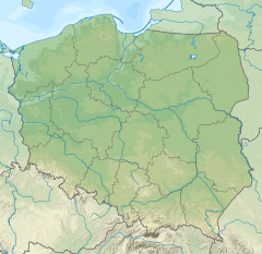
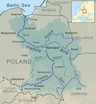
Kisielina is a river in Poland. It flows for 41,37 km (25,7 mi)[2] and feeds off a catchment area of 166,2 km² (64,2 sq mi) before feeding itself into the Vistula,[3] being its right bank tributary.
Kisielina starts on the northern slopes of the Dąbrowa [pl] hill in the vicinity of the village Łysa Góra in the Wiśnicz Foothills [pl]. It is joined by its tributaries: Pokrzywka, Upust (Ulga, right) and Zabawski Ditch (right).
The partial regulation of riverbed from Sufczyn to Biadoliny Szlacheckie took place from 2002 to 2005.
See also
References
- ^ General Geodesic Office of Poland. "Kisielina on the Polish Infrastructure Information map portal". Retrieved 2017-09-05.
- ^ a b National Water Management Board. "Kisielina on the map portal of the National Water Management Board (search result)". Archived from the original on 2017-09-01. Retrieved 2017-09-05.
{{cite web}}: External link in|author= - ^ General Geodesic Office. "Geographical nomenclature of Poland. Volume 1. Hydronyms. Part 1. Flowing water, springs, waterfalls" (PDF) (in Polish). p. 112. Retrieved 2017-09-05.
- v
- t
- e
Tributaries of the Vistula River
- Biała Wisełka
- Czarna Wisełka
- Krajka
- Pszczynka
- Gostynia
- Przemsza
- Chech
- Rudno
- Sanka
- Rudawa
- Prądnik
- Dłubnia
- Roporek
- Szreniawa
- Nidzica
- Nida
- Strumień
- Czarna
- Koprzywianka
- Opatówka
- Kamienna
- Krępianka
- Iłżanka
- Zwoleńka
- Plewka
- Zagożdżonka
- Radomka
- Pilica
- Czarna
- Jeziorka
- Bzura
- Skrwa Lewa
- Zgłowiączka
- Tążyna
- Zielona
- Brda
- Wda
- Wierzyca
- Brennica
- Iłownica
- Biała
- Soła
- Skawa
- Skawinka
- Wilga (Krakow)
- Drwinka
- Raba
- Gróbka
- Uszwica
- Kisielina
- Dunajec
- Breń
- Brnik
- Wisłoka
- Babulówka
- Trześniówka
- Łęg
- San
- Sanna
- Wyżnica
- Chodelka
- Bystra
- Kurówka
- Wieprz
- Okrzejka
- Promnik
- Wilga (Garwolin)
- Świder
- Kanał Żerański
- Narew
- Mołtawa
- Słupianka
- Rosica
- Brzeźnica
- Skrwa Prawa
- Mień
- Drwęca
- Bacha
- Struga
- Osa
- Liwa
- Mała Wisełka (Polska Wisła)
- Nogat
- Leniwka
- Szkarpawa
- Vistula Lagoon
- Śmiała Wisła
- Martwa Wisła
- Przekop Canal
This article related to a river in Poland is a stub. You can help Wikipedia by expanding it. |
- v
- t
- e


