Kolasib district
District of Mizoram in India
Kolasib district | |
|---|---|
District of Mizoram | |
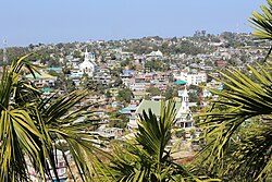 View of Kolasib | |
 Location in Mizoram | |
 Kolasib district | |
| Country | India |
| State | Mizoram |
| Headquarters | Kolasib |
| Government | |
| • Lok Sabha constituencies | Mizoram |
| • Vidhan Sabha constituencies | 3 |
| Area | |
| • Total | 1,382.51 km2 (533.79 sq mi) |
| Population (2011) | |
| • Total | 83,955 |
| • Density | 61/km2 (160/sq mi) |
| Demographics | |
| • Literacy | 93.50 |
| • Sex ratio | 956 |
| Time zone | UTC+05:30 (IST) |
| Website | kolasib |
Kolasib district is one of the eleven districts of Mizoram state in India.
Geography
Hydrology
Kolasib district has one completed Dam, Serlui B Dam[1] and two under construction Bairabi Dam[2] and Tuirial Dam Construction recommenced in September 2011.[3]
Demographics
| Year | Pop. | ±% p.a. |
|---|---|---|
| 1971 | 26,983 | — |
| 1981 | 38,432 | +3.60% |
| 1991 | 48,769 | +2.41% |
| 2001 | 65,960 | +3.07% |
| 2011 | 83,955 | +2.44% |
| source:[4] | ||
| Religions in Kolasib district (2011)[5] | ||||
|---|---|---|---|---|
| Religion | Percent | |||
| Christianity | 89.58% | |||
| Islam | 5.27% | |||
| Hinduism | 4.76% | |||
| Other or not stated | 0.39% | |||
According to the 2011 census Kolasib district has a population of 83,955, roughly equal to the nation of Andorra.[6] This gives it a ranking of 620th in India (out of a total of 640). The district has a population density of 61 inhabitants per square kilometre (160/sq mi). Its population growth rate over the decade 2001-2011 was 27.28%. Kolasib has a sex ratio of 956 females for every 1000 males, and a literacy rate of 93.50%. 55.84% of the population lives in urban areas. Scheduled Tribes make up 87.67% of the population.[7]
According to the 2011 census, 75.93% of the population spoke Mizo, 7.56% Hmar, 5.30% Bengali, 4.63% Tripuri, 1.90% Nepali and 1.33% Hindi as their first language.[8]
References
- ^ "SerluiB A Milestone in the Power Sector". Eastern Panorama. 20 October 2010. Archived from the original on 18 February 2013. Retrieved 8 August 2012.
- ^ Lalfakzuala. "Bairabi Dam Project 80MW leh TLAWNG HEP 55MW TAN MOU ZIAKFEL". DIPR Mizoram. Archived from the original on 8 January 2014. Retrieved 13 August 2012.
- ^ "Tuirial Project To Be Completed by 2014". SINLUNG. 11 November 2011. Retrieved 5 August 2012.
- ^ Decadal Variation In Population Since 1901
- ^ "Table C-01 Population By Religion: Mizoram". census.gov.in. Registrar General and Census Commissioner of India. 2011.
- ^ US Directorate of Intelligence. "Country Comparison:Population". Archived from the original on 13 June 2007. Retrieved 1 October 2011.
198 Andorra 84,825 July 2011 est.
- ^ "District Census Handbook: Kolasib" (PDF). censusindia.gov.in. Registrar General and Census Commissioner of India. 2011.
- ^ a b "Table C-16 Population By Mother Tongue: Mizoram". censusindia.gov.in. Registrar General and Census Commissioner of India. 2011.
External links
- Kolasib district website
- Kolasib website
Places adjacent to Kolasib district | |
|---|---|


- v
- t
- e
Kolasib district
- Bairabi
- Bilkhawthlir
- Builum Khawhlui
- Eranchiparamb
- Hortoki
- Kolasib (district headquarters)
- North Kawnpui
- Vairengte
| |
|---|---|
| State symbols | |
| History |
|
| Government | |
| Districts | |
| Urban Areas | |
| Infrastructure | |
| Education | |
| Tourist attractions | |
| Protected areas | |
| Culture | |
| Topics | |

24°13′48″N 92°40′48″E / 24.23000°N 92.68000°E / 24.23000; 92.68000


