Krông Bông district
You can help expand this article with text translated from the corresponding article in Vietnamese. (March 2009) Click [show] for important translation instructions.
- View a machine-translated version of the Vietnamese article.
- Machine translation, like DeepL or Google Translate, is a useful starting point for translations, but translators must revise errors as necessary and confirm that the translation is accurate, rather than simply copy-pasting machine-translated text into the English Wikipedia.
- Do not translate text that appears unreliable or low-quality. If possible, verify the text with references provided in the foreign-language article.
- You must provide copyright attribution in the edit summary accompanying your translation by providing an interlanguage link to the source of your translation. A model attribution edit summary is
Content in this edit is translated from the existing Vietnamese Wikipedia article at [[:vi:Krông Bông]]; see its history for attribution. - You may also add the template
{{Translated|vi|Krông Bông}}to the talk page. - For more guidance, see Wikipedia:Translation.
District in Central Highlands, Vietnam
Krông Bông district Huyện Krông Bông | |
|---|---|
| Country |  Vietnam Vietnam |
| Region | Central Highlands |
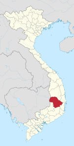
| Province | Đắk Lắk |
| Capital | Krông Kmar |
| Area | |
| • Land | 480 sq mi (1,250 km2) |
| Population (2018) | |
| • Total | 94,560 |
| Time zone | UTC+7 (Indochina Time) |
Krông Bông is a district of Vietnam's Đắk Lắk province. The name is originally from the language of an ethnic group in the Central Highlands.
Administration
The chief town of Krông Bông is Krông Kmar. There are 13 communities: Hòa Sơn, Hòa Lễ, Hòa Phong, Hòa Thành, Hòa Tân, Cư Kty, Yang Réh, Ea Trul, Yang Mao, Yang Kang, Cư Drăm, Cư Pui and Khuê Ngọc Điền.
Geography
A high percentage of the area is covered by tropical forest, therefore, Krông Bông's climate is relatively cool and pleasant. The average temperature is about 25 degrees Celsius.
In addition, Krông Bông has one of the largest national parks of Vietnam, Chư Yang Sin National Park, which is named after the highest mountain in Đắk Lắk province.
Krông Kmar, the main town of Krông Bông, is a small town in a valley surrounded by the Chư Yang Sin mountain system.
Economy
Unlike many other districts of Đắk Lắk, coffee is not the main crop due to Krông Bông's environmental conditions, such as the lack of red basaltic soil. Cashew, cassava and pepper are the most important agricultural products.
A large power plant has been built at Krông Kmar Waterfall—one of the most beautiful waterfalls in Đắk Lắk—to supply electricity for the entire surrounding area.
As of 2003, the district had a population of 82,530.[1] The district covers an area of 1,250 km2. The district capital lies at Krông Kmar.[1]
References
- ^ a b "Districts of Vietnam". Statoids. Retrieved March 13, 2009.
External links
Official website : https://web.archive.org/web/20160111034150/http://krongbong.org/
12°30′00″N 108°30′00″E / 12.500°N 108.500°E / 12.500; 108.500
- v
- t
- e
Districts of Vietnam Central Highlands

※ denotes provincial seat.
| ||
|---|---|---|
Capital: Buôn Ma Thuột | ||
| Buôn Ma Thuột |
|  |
| Buôn Hồ |
| |
| Buôn Đôn District | ||
| Cư Kuin District |
| |
| Cư M'gar District | ||
| Ea H'leo District | ||
| Ea Kar District | ||
| Ea Súp District |
| |
| Krông Ana District | ||
| Krông Bông District |
| |
| Krông Buk District |
| |
| Krông Năng District |
| |
| Krông Pắk District |
| |
| Lắk District |
| |
| M'Đrăk District | ||


