Lahachok
Place in Gandaki Zone, Nepal
Lahachowk लाहाचोक | |
|---|---|
28°19′N 83°55′E / 28.31°N 83.92°E / 28.31; 83.92 | |
| Country | Nepal |
| Zone | Gandaki Zone |
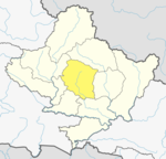
| District | Kaski District |
| Gaunpalika (Rural Municipality) | Machhapuchchhre |
| Ward | Machhapuchchhre - 4 |
| Population (1991) | |
| • Total | 3,188 |
| Time zone | UTC+5:45 (Nepal Time) |
Lahachowk (Nepali : लाहाचोक ) is a village in Machhapuchchhre Gaunpalika , in the Kaski District, in the Gandaki Zone of northern-central Nepal. According to the 2011 National Population and Housing Census, it had a population of 3,129 in 829 individual households.[1]
Lahachowk is not far from Mount Machhapuchchhre, a mountain in the Annapurna Himal. The village is at the altitude of 1,200 metres (3,937 ft) above sea level. It is about 13 km (8 mi) north-west of Pokhara. The village is ethnically and culturally diverse. Major ethnic groups in the village are Brahmin (43%), Dalit (28%), Chhetri (including Thakuri) (14%), and indigenous groups such as Gurung, Newar and Magar. The society is largely based on a caste structure. Higher castes like Brahmin and Chhetri have greater access to and control over resources and means of production. The people of higher caste generally have a higher educational status. The Hindu religion predominates, followed by Buddhism and a small number of Christians. The society in Lahachowk is a patriarchal one. The major occupation in the village is agriculture, which occupies around 46.7% of the population. Next are the labourers[clarification needed], up to 30.9%. Around 5.3% are working abroad, and government jobs account for 4.9%. Other jobs occupy around 11.5%, while business[clarification needed] accounts for just 0.7%.Madhusudhan Adhikari is the ward chairperson of the village along with elected ward members like Shreedevi, Rabi Adhikari and 2 others.
References
- ^ "Nepal Census 2001". Nepal's Village Development Committees. Digital Himalaya. Archived from the original on 12 October 2008. Retrieved 30 September 2008.
National Population and Housing Census, 2011
External links
- UN map of the municipalities of Kaski District
- v
- t
- e
Headquarters: Pokhara
- Arba Vijaya
- Armala
- Begnas
- Bhachok
- Bhadaure Tamagi
- Bhalam
- Bharat Pokhari
- Chapakot
- Dangsing
- Deurali
- Dhampus
- Dhikur Pokhari
- Dhital
- Ghachok
- Ghandruk
- Hansapur
- Hemja
- Kahun
- Kalika
- Kaskikot
- Kristinachnechaur
- Lahachok
- Lamachaur
- Lekhnath Municipality
- Lumle
- Lwangghale
- Machhapuchchhre
- Majhthana
- Mala
- Mauja
- Mijuredanda
- Namarjung
- Nirmalpokhari
- Parche
- Pumdibhumdi
- Puranchaur
- Rakhi
- Ribhan
- Rupakot
- Saimarang
- Salyan
- Sarangkot
- Sardikhola
- Shisuwa
- Siddha
- Sildujure
- Thumakodada
- Thumki
 | This article about a location in the Kaski District of Nepal is a stub. You can help Wikipedia by expanding it. |
- v
- t
- e


