List of Local Government Areas in Yobe State
State of Nigeria
State in Nigeria

Flag

Seal
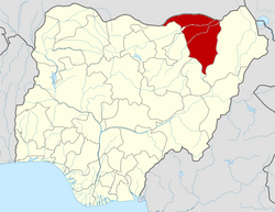
Location of Yobe State in Nigeria
Yobe was created on 27 August 1991. It is a mainly agricultural state, and it is a state located in northeastern Nigeria.[4] Yobe State was carved out of Borno State. The capital of Yobe State is Damaturu; its largest and most populated city is Potiskum.
LGAs
Yobe State consists of 17 local government areas (or LGAs).[5][6] They are:
External links
- Yobe State Government homepage
- UCLA Yobe Languages Project
- Erdal Can Alkoçlar
- Nigerian Post Office, with a map of LGAs of the state
References
- ^ "2006 PHC Priority Tables – NATIONAL POPULATION COMMISSION". population.gov.ng. Retrieved 10 October 2017.
- ^ a b "TelluBase—Nigeria Fact Sheet (Tellusant Public Service Series)" (PDF). Tellusant. Retrieved 1 June 2023.
- ^ "Sub-national HDI - Area Database - Global Data Lab". hdi.globaldatalab.org. Retrieved 13 September 2018.
- ^ "Yobe State of Nigeria :: Nigeria Information & Guide". www.nigeriagalleria.com. Retrieved 11 November 2022.
- ^ "Yobe State". Nigerian Investment Promotion Commission. 9 January 2019. Retrieved 11 November 2022.
- ^ Admin (23 February 2019). "Local Government Areas in Yobe State". Nigeria Postcode. Retrieved 11 November 2022.
- v
- t
- e
| |
|---|---|
Federal Capital Territory | |
 Nigeria portal Nigeria portal |
Portal:
 Nigeria


