List of archaeological sites on the National Register of Historic Places in Illinois
This is a list of archaeological sites on the National Register of Historic Places in Illinois.
Historic sites in the United States qualify to be listed on the National Register of Historic Places by passing one or more of four different criteria; Criterion D permits the inclusion of proven and potential archaeological sites.[1] More than eighty different sites in Illinois are listed under this criterion, including both Native American and European sites.[2] This list includes all properties in Illinois that qualify under this criterion.
Map all coordinates using OpenStreetMap
Download coordinates as:
- KML
- GPX (all coordinates)
- GPX (primary coordinates)
- GPX (secondary coordinates)
Current listings
| [3] | Landmark name | Image | Location | County | Culture | Comments |
|---|---|---|---|---|---|---|
| 1 | Albany Mounds Site | Albany: Albany Mounds Trail 41°46′40″N 90°13′48″W / 41.77778°N 90.23000°W / 41.77778; -90.23000 (Albany Mounds Site)[4] | Whiteside | Middle Woodland: Hopewell | ||
| 2 | Alton Military Prison Site | 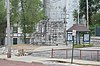 | Alton: inside the block bounded by Broadway and William, 4th, and Mill Sts. 38°53′30″N 90°11′26″W / 38.89167°N 90.19056°W / 38.89167; -90.19056 (Alton Military Prison Site)[5] | Madison | Euro-American | |
| 3 | Apple River Fort Site |  | Elizabeth: 0.25 miles east-southeast of the junction of Myrtle and Illinois Sts. 42°19′6″N 90°12′53″W / 42.31833°N 90.21472°W / 42.31833; -90.21472 (Apple River Fort Site)[6] | Jo Daviess | Euro-American | |
| 4 | Warren Bane Site | Ellsworth: northeast of the junction of 3000E and 750N 40°23′51″N 88°40′44″W / 40.39750°N 88.67889°W / 40.39750; -88.67889 (Bane, Warren, Site)[7] | McLean | Kickapoo | ||
| 5 | Beattie Park Mound Group | 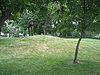 | Rockford: N. Main St. between Park and Mound Aves. 42°16′28″N 89°5′30″W / 42.27444°N 89.09167°W / 42.27444; -89.09167 (Beattie Park Mound Group)[8] | Winnebago | Late Woodland | |
| 6 | Bieker-Wilson Village Site |  | New Haven: Sandy Slough, southeast of the junction of County Road 300N and 1650E 37°55′2″N 88°4′34″W / 37.91722°N 88.07611°W / 37.91722; -88.07611 (Bieker-Wilson Village Site)[9] | White | Late Woodland and Mississippian | |
| 7 | Briscoe Mounds | 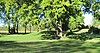 | Channahon: Front St. along the Des Plaines River 41°25′10″N 88°13′8″W / 41.41944°N 88.21889°W / 41.41944; -88.21889 (Briscoe Mounds)[10] | Will | Oneota | |
| 8 | Cahokia Mounds | 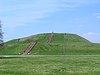 | Collinsville: 7850 Collinsville Rd. at Cahokia Mounds State Park 38°39′9″N 90°4′0″W / 38.65250°N 90.06667°W / 38.65250; -90.06667 (Cahokia Mounds)[11] | St. Clair | Mississippian | |
| 9 | Carrier Mills Archeological District |  | Carrier Mills: along the Saline River south of Carrier Mills 37°39′28″N 88°37′4″W / 37.65778°N 88.61778°W / 37.65778; -88.61778 (Carrier Mills Archeological District)[12] | Saline | Late Archaic through Middle Woodland | |
| 10 | John Chapman Village Site |  | Hanover: western side of Illinois Route 84, south of Hanover 42°14′33″N 90°22′3″W / 42.24250°N 90.36750°W / 42.24250; -90.36750 (John Chapman Village Site)[13] | Jo Daviess | Late Woodland and Mississippian | |
| 11 | Civilian Conservation Corps Camp Shiloh Encampment Site |  | Pleasant Grove Township: northwestern quarter of the northeastern quarter of the southwestern quarter of Section 21, Township 11 North, Range 9 East, of the Illinois Third Principal Meridian 39°22′52″N 88°12′34″W / 39.38111°N 88.20944°W / 39.38111; -88.20944 (Civilian Conservation Corps Camp Shiloh Encampment Site)[14] | Coles | Euro-American | |
| 12 | Clear Lake Site | Manito: junction of 1200E and 2600N in Sand Ridge State Park 40°26′8″N 89°54′0″W / 40.43556°N 89.90000°W / 40.43556; -89.90000 (Clear Lake Site)[15] | Mason and Tazewell | Late Woodland and Mississippian | ||
| 13 | Cleiman Mound and Village Site |  | Gorham: northeast of the junction of Big Lake and Thomas Town Rds. 37°46′50″N 89°31′51″W / 37.78056°N 89.53083°W / 37.78056; -89.53083 (Cleiman Mound and Village Site)[16] | Jackson | Middle Woodland through Mississippian | |
| 14 | Collins Archeological District |  | Danville: west of Lake Mingo at Kennekuk County Park 40°12′28″N 87°44′32″W / 40.20778°N 87.74222°W / 40.20778; -87.74222 (Collins Archeological District)[17] | Vermilion | Late Woodland | |
| 15 | Corbin Farm Site | 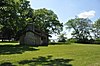 | Utica: Long Point, between Illinois Route 71 and the Illinois River 41°18′37″N 88°56′21″W / 41.31028°N 88.93917°W / 41.31028; -88.93917 (Corbin Farm Site)[18] | LaSalle | Late Woodland and Upper Mississippian | |
| 16 | Dickson Mounds |  | Lewistown: off County Road 4 40°21′2″N 90°6′50″W / 40.35056°N 90.11389°W / 40.35056; -90.11389 (Dickson Mounds)[19] | Fulton | Mississippian | |
| 17 | Dogtooth Bend Mounds and Village Site |  | Willard: western end of Lake Milligan 37°3′50″N 89°20′5″W / 37.06389°N 89.33472°W / 37.06389; -89.33472 (Dogtooth Bend Mounds and Village Site)[20] | Alexander | Mississippian | |
| 18 | Duffy site |  | New Haven: Sally Hardin Rd., southeast of New Haven 37°51′31″N 88°5′47″W / 37.85861°N 88.09639°W / 37.85861; -88.09639 (Duffy site)[21] | Gallatin | Late Woodland | |
| 19 | Duncan Farm |  | Grafton: southern side of Illinois Route 100, ½ mile west of Brussels Ferry 38°58′5″N 90°30′49″W / 38.96806°N 90.51361°W / 38.96806; -90.51361 (Duncan Farm)[22] | Jersey | Paleoindian through Mississippian | |
| 20 | Emerald Mound and Village Site | 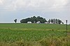 | Lebanon: northwest of the junction of Emerald Mound Grange and Midgley Neiss Rd. 38°37′50″N 89°47′9″W / 38.63056°N 89.78583°W / 38.63056; -89.78583 (Emerald Mound and Village Site)[23] | St. Clair | Mississippian | |
| 21 | Evelyn Site | Newark: midway between Newark and Lisbon Center Rds., east of Big Grove Rd. 41°31′49″N 88°30′26″W / 41.53028°N 88.50722°W / 41.53028; -88.50722 (Evelyn Site)[24] | Kendall | Archaic | ||
| 22 | Farm Creek Section |  | East Peoria: southern side of Farm Creek 40°40′40″N 89°29′25″W / 40.67778°N 89.49028°W / 40.67778; -89.49028 (Farm Creek Section)[25] | Tazewell | Not applicable | |
| 23 | Fort Massac Site | 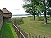 | Metropolis: southeast of Metropolis on the Ohio River 37°8′40″N 88°41′40″W / 37.14444°N 88.69444°W / 37.14444; -88.69444 (Fort Massac Site)[26] | Massac | Euro-American | |
| 24 | French Colonial Historic District |  | Prairie du Rocher: from Fort Chartres State Park to Kaskaskia Island 38°5′20″N 90°10′0″W / 38.08889°N 90.16667°W / 38.08889; -90.16667 (French Colonial Historic District)[27] | Monroe and Randolph | Paleoindian through Mississippian and Euro-American | |
| 25 | Giant City Stone Fort Site |  | Makanda: Stone Fort Rd. 37°37′24″N 89°11′49″W / 37.62333°N 89.19694°W / 37.62333; -89.19694 (Giant City Stone Fort Site)[28] | Jackson | Late Woodland | |
| 26 | Golden Eagle-Toppmeyer Site |  | Brussels: western side of Quarry Rd., south of Illinois River Rd. 38°54′55″N 90°31′13″W / 38.91528°N 90.52028°W / 38.91528; -90.52028 (Golden Eagle-Toppmeyer Site)[29] | Calhoun | Late Woodland | |
| 27 | Grand Tower Mining, Manufacturing and Transportation Company Site | 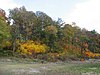 | Grand Tower: Devil's Backbone Park 37°38′12″N 89°30′33″W / 37.63667°N 89.50917°W / 37.63667; -89.50917 (Grand Tower Mining, Manufacturing and Transportation Company Site)[30] | Jackson | Euro-American | |
| 28 | Griggsville Landing Lime Kiln | Valley City: Township Road 490, north of Napoleon Hollow 39°41′23″N 90°38′45″W / 39.68972°N 90.64583°W / 39.68972; -90.64583 (Griggsville Landing Lime Kiln)[31] | Pike | Euro-American | ||
| 29 | Horseshoe Lake Mound and Village Site |  | Granite City: southwest of the junction of Illinois Route 111 and Horseshoe Lake Rd. 38°42′15″N 90°4′7″W / 38.70417°N 90.06861°W / 38.70417; -90.06861 (Horseshoe Lake Mound and Village Site)[32] | Madison | Late Woodland through Mississippian | |
| 30 | Hotel Plaza Site |  | Utica: northeast of the lodge at Starved Rock State Park 41°19′11″N 88°59′34″W / 41.31972°N 88.99278°W / 41.31972; -88.99278 (Hotel Plaza Site)[33] | LaSalle | Archaic through Upper Mississippian | |
| 31 | Hubele Mounds and Village Site |  | Maunie: east of the junction of County Roads 950N and 1900E 38°1′0″N 88°1′56″W / 38.01667°N 88.03222°W / 38.01667; -88.03222 (Hubele Mounds and Village Site)[34] | White | Middle Woodland: Hopewell | |
| 32 | Kamp Mound Site |  | Kampsville: Illinois Route 100, north of Kampsville 39°19′56″N 90°37′15″W / 39.33222°N 90.62083°W / 39.33222; -90.62083 (Kamp Mound Site)[35] | Calhoun | Woodland | |
| 33 | Kellogg's Grove | 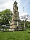 | Kent: southeast of Kent 42°17′44″N 89°52′52″W / 42.29556°N 89.88111°W / 42.29556; -89.88111 (Kellogg's Grove)[36] | Stephenson | Sauk and Euro-American | |
| 34 | Kincaid site |  | Brookport: Newcut Rd. 37°4′50″N 88°29′31″W / 37.08056°N 88.49194°W / 37.08056; -88.49194 (Kincaid Site)[37] | Massac and Pope | Mississippian | |
| 35 | Kolmer Site | 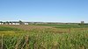 | Prairie du Rocher: Levee Rd., west of Fort Chartres State Park 38°5′30″N 90°10′51″W / 38.09167°N 90.18083°W / 38.09167; -90.18083 (Kolmer Site)[38] | Randolph | Michigamea | |
| 36 | Koster Site | Eldred: 200 yards (180 m) east of the Eldred-Hillview road, 5.5 miles (8.9 km) south of Eldred 39°12′30″N 90°33′0″W / 39.20833°N 90.55000°W / 39.20833; -90.55000 (Koster Site)[39] | Greene | Archaic | ||
| 37 | Kuhn Station Site |  | Edwardsville: Rosewood Hills Dr. 38°47′11″N 89°51′38″W / 38.78639°N 89.86056°W / 38.78639; -89.86056 (Kuhn Station Site)[40] | Madison | Mississippian | |
| 38 | Larson Site |  | Lewistown: Waterford Rd. north of the Waterford Cemetery 40°20′36″N 90°7′52″W / 40.34333°N 90.13111°W / 40.34333; -90.13111 (Larson Site)[41] | Fulton | Late Woodland through Mississippian | |
| 39 | Lebanon Historic District | Lebanon: irregular pattern centered along St. Louis and Belleville Sts. 38°36′3″N 89°49′21″W / 38.60083°N 89.82250°W / 38.60083; -89.82250 (Lebanon Historic District)[42] | St. Clair | Late Woodland through Mississippian | ||
| 40 | Little Beaver Site | Utica: Starved Rock State Park, west of Illinois Route 178 41°19′10″N 89°1′16″W / 41.31944°N 89.02111°W / 41.31944; -89.02111 (Little Beaver Site)[43] | LaSalle | Middle Woodland | ||
| 41 | Lunsford-Pulcher Archeological Site |  | Columbia: western side of Oklahoma Hill Rd. 38°29′40″N 90°13′52″W / 38.49444°N 90.23111°W / 38.49444; -90.23111 (Lunsford-Pulcher Archeological Site)[44] | Monroe and St. Clair | Mississippian | |
| 42 | Marseilles Hydro Plant |  | Marseilles: Commercial St. 41°19′35″N 88°42′52″W / 41.32639°N 88.71444°W / 41.32639; -88.71444 (Marseilles Hydro Plant)[45] | LaSalle | Euro-American | |
| 43 | Pierre Martin House |  | North Dupo: 1st St. at Old Illinois Route 3 38°32′50″N 90°11′56″W / 38.54722°N 90.19889°W / 38.54722; -90.19889 (Martin, Pierre, House)[46] | St. Clair | Euro-American | |
| 44 | Mayberry Mound and Village Site |  | Sims: northeast of the junction of County Road 900E and the Skillet Fork 38°19′15″N 88°31′30″W / 38.32083°N 88.52500°W / 38.32083; -88.52500 (Mayberry Mound and Village Site)[47] | Wayne | Archaic | |
| 45 | McCune Mound and Village Site |  | Sterling: western side of Illinois Route 40, north of Science Ridge Rd. 41°50′0″N 89°42′24″W / 41.83333°N 89.70667°W / 41.83333; -89.70667 (McCune Mound and Village Site)[48] | Whiteside | Upper Mississippian | |
| 46 | Millstone Bluff |  | Glendale: Illinois Route 147 west of its junction with Illinois Route 145 37°28′1″N 88°41′17″W / 37.46694°N 88.68806°W / 37.46694; -88.68806 (Millstone Bluff)[49] | Pope | Late Woodland through Mississippian | |
| 47 | Millville Town Site |  | Apple River: Apple River Canyon State Park, 8663 E. Canyon Rd. 42°26′48″N 90°3′9″W / 42.44667°N 90.05250°W / 42.44667; -90.05250 (Millville Town Site)[50] | Jo Daviess | Euro-American | |
| 48 | Mitchell Archeological Site | 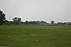 | Mitchell: western end of University Dr. 38°45′32″N 90°5′10″W / 38.75889°N 90.08611°W / 38.75889; -90.08611 (Mitchell Archeological Site)[51] | Madison | Mississippian | |
| 49 | Modoc Rock Shelter |  | Modoc: northeastern side of County Road 7 southeast of Roscow Hollow Rd. 38°3′46″N 90°3′50″W / 38.06278°N 90.06389°W / 38.06278; -90.06389 (Modoc Rock Shelter)[52] | Randolph | Early Archaic through Mississippian | |
| 50 | Morris Wide Water Canal Boat Site |  | Morris: E. Washington St. 41°21′58″N 88°24′13″W / 41.36611°N 88.40361°W / 41.36611; -88.40361 (Morris Wide Water Canal Boat Site)[53] | Grundy | Euro-American | |
| 51 | Mound House Site | Hillview: Eastern bank of the Illinois River, ½ mile west of the end of 600E 39°29′36″N 90°35′1″W / 39.49333°N 90.58361°W / 39.49333; -90.58361 (Mound House Site)[54] | Greene | Early Woodland through Mississippian | ||
| 52 | Naples Archeological District | Naples: eastern bank of the Illinois River south of Naples 39°44′18″N 90°37′6″W / 39.73833°N 90.61833°W / 39.73833; -90.61833 (Naples Archeological District)[55] | Scott | Early Woodland through Mississippian | ||
| 53 | Naples Mound 8 |  | Griggsville: north of Interstate 72 just west of the Illinois River 39°41′15″N 90°39′8″W / 39.68750°N 90.65222°W / 39.68750; -90.65222 (Naples Mound 8)[56] | Pike | Middle Woodland: Hopewell | |
| 54 | New Philadelphia Town Site |  | Barry: Township Road 156, east of Barry 39°41′45″N 90°57′35″W / 39.69583°N 90.95972°W / 39.69583; -90.95972 (New Philadelphia Town Site)[57] | Pike | Euro-American | |
| 55 | Nutwood Site | Nutwood: western side of Illinois Route 100, 500 feet south of the Narrows Creek bridge 39°4′54″N 90°33′23″W / 39.08167°N 90.55639°W / 39.08167; -90.55639 (Nutwood Site)[58] | Jersey | Late Woodland | ||
| 56 | Ogden-Fettie Site |  | Lewistown: south of Lewistown 40°20′29″N 90°7′3″W / 40.34139°N 90.11750°W / 40.34139; -90.11750 (Ogden-Fettie Site)[59] | Fulton | Middle Woodland: Hopewell | |
| 57 | Old Kaskaskia Village |  | Ottawa: Dee Bennett Rd. on the northern side of the Illinois River 41°19′19″N 88°57′36″W / 41.32194°N 88.96000°W / 41.32194; -88.96000 (Old Kaskaskia Village)[60] | LaSalle | Kaskaskia | |
| 58 | Orendorf Site | Canton: western side of U.S. Route 24 near the northern end of the Duck Creek Cooling Pond 40°29′15″N 89°57′6″W / 40.48750°N 89.95167°W / 40.48750; -89.95167 (Orendorf Site)[61] | Fulton | Mississippian | ||
| 59 | Orr-Herl Mound and Village Site |  | Rosiclare: northern bank of the Ohio River midway between Elizabethtown and Rosiclare 37°26′4″N 88°19′39″W / 37.43444°N 88.32750°W / 37.43444; -88.32750 (Orr-Herl Mound and Village Site)[62] | Hardin | Mississippian | |
| 60 | Piney Creek Site | 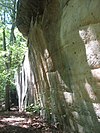 | Campbell Hill: north of Piney Creek in Piney Creek Ravine Nature Preserve 37°53′49″N 89°38′10″W / 37.89694°N 89.63611°W / 37.89694; -89.63611 (Piney Creek Site)[63] | Randolph | Late Woodland through Mississippian | |
| 61 | Piney Creek South Site |  | Campbell Hill: south of Piney Creek in Piney Creek Ravine Nature Preserve 37°53′47″N 89°38′9″W / 37.89639°N 89.63583°W / 37.89639; -89.63583 (Piney Creek South Site)[64] | Randolph | Late Woodland | |
| 62 | Piney Creek West Site |  | Campbell Hill: north of Piney Creek in Piney Creek Ravine Nature Preserve 37°53′49″N 89°38′14″W / 37.89694°N 89.63722°W / 37.89694; -89.63722 (Piney Creek West Site)[65] | Randolph | Late Woodland | |
| 63 | Riverton Site |  | Palestine: northern side of 1150th Avenue immediately west of the Wabash River, northeast of Palestine 39°1′18″N 87°34′32″W / 39.02167°N 87.57556°W / 39.02167; -87.57556 (Riverton Site)[66] | Crawford | Late Archaic: Riverton | |
| 64 | Rock Island Arsenal |  | Rock Island: Rock Island in the Mississippi River 41°31′0″N 90°33′0″W / 41.51667°N 90.55000°W / 41.51667; -90.55000 (Rock Island Arsenal)[67] | Rock Island | Euro-American | |
| 65 | Rockwell Mound | 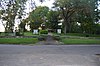 | Havana: Rockwell Park at the northern end of Orange St. 40°18′18″N 90°3′49″W / 40.30500°N 90.06361°W / 40.30500; -90.06361 (Rockwell Mound)[68] | Mason | Middle Woodland: Havana Hopewell | |
| 66 | John Roy Site |  | Clayton: southwest of the junction of 1700th Ave. and 2950th St. 39°59′56″N 90°56′59″W / 39.99889°N 90.94972°W / 39.99889; -90.94972 (Roy, John, Site)[69] | Adams | Late Woodland | |
| 67 | Saline Springs | 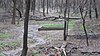 | Equality: Salt Well Rd., ½ mile west of the Saline River bridge 37°42′18″N 88°17′43″W / 37.70500°N 88.29528°W / 37.70500; -88.29528 (Saline Springs)[70] | Gallatin | Early Woodland through Mississippian and Euro-American | |
| 68 | Schudel No. 2 Site |  | Hamburg: 200N, west of Mississippi River Rd. 39°9′49″N 90°41′36″W / 39.16361°N 90.69333°W / 39.16361; -90.69333 (Schudel No. 2 Site)[71] | Calhoun | Early Woodland through Mississippian | |
| 69 | Shaky Shelter Site | Utica: in a ravine south of Illinois Route 71 at Starved Rock State Park 41°18′22″N 88°56′41″W / 41.30611°N 88.94472°W / 41.30611; -88.94472 (Shaky Shelter Site)[72] | LaSalle | Upper Mississippian | ||
| 70 | Sheets Site | Lewistown: County Road 14, west of Lewistown 40°24′1″N 90°12′40″W / 40.40028°N 90.21111°W / 40.40028; -90.21111 (Sheets Site)[73] | Fulton | Late Archaic through Early Woodland | ||
| 71 | Sinnissippi site |  | Sterling: Sinnissippi Park, off 13th St. 41°47′49″N 89°39′50″W / 41.79694°N 89.66389°W / 41.79694; -89.66389 (Sinnissippi Site)[74] | Whiteside | Middle Woodland: Hopewell | |
| 72 | Sleeth Site |  | Liverpool: northeast of the junction of U.S. Route 24 and Pollitt Rd. 40°25′27″N 90°0′0″W / 40.42417°N 90.00000°W / 40.42417; -90.00000 (Sleeth Site)[75] | Fulton | Mississippian | |
| 73 | Starved Rock | 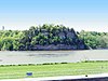 | Ottawa: 6 miles from Ottawa on Illinois Route 71, Starved Rock State Park 41°19′8″N 88°59′36″W / 41.31889°N 88.99333°W / 41.31889; -88.99333 (Starved Rock)[76] | LaSalle | Kaskaskia and Euro-American | |
| 74 | Stoner Site |  | Robinson: eastern side of 1550th St. between 1300th and 1235th Aves. 39°2′18″N 87°39′20″W / 39.03833°N 87.65556°W / 39.03833; -87.65556 (Stoner Site)[77] | Crawford | Allison-Lamotte | |
| 75 | Swan Island Site |  | Palestine: northern side of the junction of the Wabash River and the Crawford/Lawrence county line 38°51′12″N 87°32′18″W / 38.85333°N 87.53833°W / 38.85333; -87.53833 (Swan Island Site)[78] | Crawford | Late Archaic: Riverton | |
| 76 | Tampico Mounds | Maples Mill: west of the junction of U.S. Route 24 and County Road 8 40°24′58″N 90°0′56″W / 40.41611°N 90.01556°W / 40.41611; -90.01556 (Tampico Mounds)[79] | Fulton | Late Woodland | ||
| 77 | Tegtmeyer Site |  | Campbell Hill: north of Piney Creek in Piney Creek Ravine Nature Preserve 37°53′51″N 89°38′16″W / 37.89750°N 89.63778°W / 37.89750; -89.63778 (Tegtmeyer Site)[80] | Randolph | Mississippian | |
| 78 | Ware Mounds and Village Site |  | Ware: west of the junction of Illinois Routes 3 and 146 at Ware 37°26′47″N 89°24′0″W / 37.44639°N 89.40000°W / 37.44639; -89.40000 (Ware Mounds and Village Site)[81] | Union | Late Woodland through Mississippian | |
| 79 | White and Company's Goose Lake Stoneware Manufactury |  | Morris: 5010 N. Jugtown Rd. 41°20′50″N 88°19′19″W / 41.34722°N 88.32194°W / 41.34722; -88.32194 (White and Company's Goose Lake Stoneware Manufactury)[82] | Grundy | Euro-American | |
| 80 | White and Company's Goose Lake Tile Works |  | Morris: 5010 N. Jugtown Rd. 41°20′46″N 88°18′59″W / 41.34611°N 88.31639°W / 41.34611; -88.31639 (White and Company's Goose Lake Tile Works)[83] | Grundy | Euro-American | |
| 81 | Wilson Mounds and Village Site |  | Maunie: within and surrounding the Marshall Ferry Cemetery at Rising Sun 37°59′57″N 88°1′55″W / 37.99917°N 88.03194°W / 37.99917; -88.03194 (Wilson Mounds and Village Site)[84] | White | Middle Woodland: Havana Hopewell | |
| 82 | Windrose Site | Bourbonnais: Kankakee River Nature Preserve, west of Bradley 41°10′20″N 87°57′3″W / 41.17222°N 87.95083°W / 41.17222; -87.95083 (Windrose Site)[85] | Kankakee | Pottawatomie |
See also
References
- ^ National Register Criteria for Evaluation, National Park Service. Accessed 2013-11-10.
- ^ "National Register Information System". National Register of Historic Places. National Park Service. July 9, 2010.
- ^ Numbers represent an ordering by significant words.
- ^ Struever, Stuart. National Register of Historic Places Inventory/Nomination: Albany Mounds Site. National Park Service, 1973-12-18, 4.
- ^ Means, Ruth, and P.H. Poehner. National Register of Historic Places Inventory/Nomination: Alton Military Prison Site. National Park Service, 1973-11-30, 10.
- ^ Harmet, A. Richard. National Register of Historic Places Inventory/Nomination: Apple River Fort Site. National Park Service, 1997-03-31, 1.
- ^ Wagner, Mark. National Register of Historic Places Inventory/Nomination: Warren Bane Site. National Park Service, 1981-02-17, 7.
- ^ Rohrbaugh, Charles L. National Register of Historic Places Inventory/Nomination: Beattie Park Mound Group. National Park Service, 1990-07-01, 11.
- ^ Maruszak, Kathleen. National Register of Historic Places Inventory/Nomination: Bieker-Wilson Village Site. National Park Service, 1977-06, 3.
- ^ Maruszak, Kathleen, and Debi A. Jones. National Register of Historic Places Inventory/Nomination: Briscoe Mounds. National Park Service, 1978-07, 9.
- ^ Weiss, Francine. National Register of Historic Places Inventory/Nomination: Cahokia Mounds. National Park Service, 1975-09-17, 13.
- ^ Maruszak, Kathleen. National Register of Historic Places Inventory/Nomination: Carrier Mills Archeological District. National Park Service, 1977-08, 2.
- ^ "Grant Propoosal: Wapello Land & Water Reserve Habitat Restoration Project Archived 2008-04-23 at the Wayback Machine". Illinois Department of Natural Resources, 2006, 2/18.
- ^ Thompson, Stephen A. National Register of Historic Places Inventory/Nomination: Civilian Conservation Corps Camp Shiloh Encampment Site. National Park Service, 2013-09-11, 11.
- ^ Maruszak, Kathleen. National Register of Historic Places Inventory/Nomination: Clear Lake Site. National Park Service, 1977-01, 3.
- ^ Pulcher, Ronald E. National Register of Historic Places Inventory/Nomination: Cleiman Mound and Village Site. National Park Service, 1975-07-30, 4.
- ^ Maruszak, Kathleen. National Register of Historic Places Inventory/Nomination: Collins Archeological District. National Park Service, 1977-04, 14.
- ^ Henning, Dale R., and Jacqueline A. Ferguson. National Register of Historic Places Inventory/Nomination: Corbin Farm Site. National Park Service, 1997-12-31, 11.
- ^ Shields, Wayne F. National Register of Historic Places Inventory/Nomination: Dickson Mounds. National Park Service, 1969-09-25, 5.
- ^ Maruszak, Kathleen. National Register of Historic Places Inventory/Nomination: Dogtooth Bend Mounds and Village Site. National Park Service, 1977-07, 5.
- ^ Winters, Howard D. An Archaeological Survey of the Wabash Valley in Illinois. Springfield: Illinois State Museum Society, 1963, 73.
- ^ Wagner, Suzanne. National Register of Historic Places Inventory/Nomination: Duncan Farm. National Park Service, 1981-07-30, 5.
- ^ Reed, Nelson A. National Register of Historic Places Inventory/Nomination: Emerald Mound and Village Site. National Park Service, 1969-09-12, 4.
- ^ Maruszak, Kathleen. National Register of Historic Places Inventory/Nomination: Evelyn Site. National Park Service, 1978-04, 7.
- ^ Kluessendorf, Joanne. National Register of Historic Places Inventory/Nomination: Farm Creek Section. National Park Service, 1991-08-20, 4.
- ^ Farrar, William G. National Register of Historic Places Inventory/Nomination: Fort Massac Site. National Park Service, 1971-03-01, 5.
- ^ Brown, Margaret K. National Register of Historic Places Inventory/Nomination: French Colonial Historic District. National Park Service, n.d., 5.
- ^ Wagner, Mark. National Register of Historic Places Inventory/Nomination: Giant City Stone Fort Site. National Park Service, 2002-04-30, 6.
- ^ Maruszak, Kathleen. National Register of Historic Places Inventory/Nomination: Golden Eagle-Toppmeyer Site. National Park Service, 1979-01, 5.
- ^ Conrad, Cynthia E. National Register of Historic Places Inventory/Nomination: Grand Tower Mining, Manufacturing and Transportation Company Site. National Park Service, 1978-03-17, 7.
- ^ Mansberger, Floyd, et al. National Register of Historic Places Inventory/Nomination: Griggsville Landing Lime Kiln. National Park Service, 1999-01-17, 5.
- ^ Wagner, Mark. National Register of Historic Places Inventory/Nomination: Horseshoe Lake Mound and Village Site. National Park Service, 1980-08-18, 6.
- ^ Henning, Dale R., and Jacqueline A. Ferguson. National Register of Historic Places Inventory/Nomination: Hotel Plaza Site. National Park Service, 1997-12-31, 14.
- ^ Bodner, Connie. National Register of Historic Places Inventory/Nomination: Hubele Mounds and Village Site. National Park Service, 1976-07, 5.
- ^ Maruszak, Kathleen. National Register of Historic Places Inventory/Nomination: Kamp Mound Site. National Park Service, 1977-07, 4.
- ^ Rodkey, Stanley F., et al. National Register of Historic Places Inventory/Nomination: Kellogg's Grove. National Park Service, 1978-01-18, 5.
- ^ Fairchilde, Jerry D. National Register of Historic Places Inventory/Nomination: Kincaid Site. National Park Service, 1982-03-10, 27.
- ^ Brown, Margaret Kimball. National Register of Historic Places Inventory/Nomination: Kolmer Site. National Park Service, n.d., 4.
- ^ Struever, Stuart. National Register of Historic Places Inventory/Nomination: Koster Site. National Park Service, 1971-11-04, 5.
- ^ van Hartesveldt, Eric N. National Register of Historic Places Inventory/Nomination: Kuhn Station Site. National Park Service, 1980-07-25, 6.
- ^ Maruszak, Kathleen. National Register of Historic Places Inventory/Nomination: Larson Site. National Park Service, 1977-09, 6.
- ^ Wagner, Robert. National Register of Historic Places Inventory/Nomination: Lebanon Historic District. National Park Service, 1977-08-09, 16.
- ^ Ferguson, Jacqueline A., and Dale R. Henning. National Register of Historic Places Inventory/Nomination: Little Beaver Site. National Park Service, 1997-12-31, 12.
- ^ Fowler, Melvin L., and Glen A. Freimuth. National Register of Historic Places Inventory/Nomination: Lunsford-Pulcher Archeological Site. National Park Service, n.d., 4.
- ^ Spets, Charles E. National Register of Historic Places Inventory/Nomination: Marseilles Hydro Plant. National Park Service, 1989-02-03, 20.
- ^ Mack, Eric. National Register of Historic Places Inventory/Nomination: Pierre Martin House. National Park Service, 1989-10-10, 17.
- ^ Bodner, Connie. National Register of Historic Places Inventory/Nomination: Mayberry Mound and Village Site. National Park Service, 1976-07, 4.
- ^ Maruszak, Kathleen A. National Register of Historic Places Inventory/Nomination: McCune Mound and Village Site. National Park Service, 1979-01, 5.
- ^ Zdzieblowski, Arthur. National Register of Historic Places Inventory/Nomination: Millstone Bluff. National Park Service, n.d., 4.
- ^ Stratton, Christopher. National Register of Historic Places Inventory/Nomination: Millville Town Site. National Park Service, 2002-09-16, 16.
- ^ Bodner, Connie. National Register of Historic Places Inventory/Nomination: Mitchell Archeological Site. National Park Service, 1976-08, 5.
- ^ Styles, Bonnie W. National Register of Historic Places Inventory/Nomination: Modoc Rock Shelter. National Park Service, 1985-01-29, 1.
- ^ Mansberger, Floyd. National Register of Historic Places Inventory/Nomination: Morris Wide Water Canal Boat Site. National Park Service, 1999-03-15, 56.
- ^ Maruszak, Kathleen. National Register of Historic Places Inventory/Nomination: Mound House Site. National Park Service, 1977-07, 4.
- ^ Maruszak, Kathleen A. National Register of Historic Places Inventory/Nomination: Naples Archeological District. National Park Service, 1978-02, 19.
- ^ Bulkstra, Jane E. National Register of Historic Places Inventory/Nomination: Naples Mound 8. National Park Service, 1975-04-22, 1.
- ^ Huttes, Michelle. National Register of Historic Places Inventory/Nomination: New Philadelphia Town Site. National Park Service, 2004-11-28, 36.
- ^ Maruszak, Kathleen. National Register of Historic Places Inventory/Nomination: Nutwood Site. National Park Service, 1977-02, 5.
- ^ Shields, Wayne F. National Register of Historic Places Inventory/Nomination: Ogden-Fettie Site. National Park Service, 1971-07-07, 4.
- ^ Weiss, Francine. National Register of Historic Places Inventory/Nomination: Old Kaskaskia Village. National Park Service, n.d., 1.
- ^ Maruszak, Kathleen. National Register of Historic Places Inventory/Nomination: Orendorf Site. National Park Service, 1976-11-09, 2.
- ^ Maruszak, Kathleen. National Register of Historic Places Inventory/Nomination: Orr-Herl Mound and Village Site. National Park Service, 1976-12, 5.
- ^ Wagner, Mark J. National Register of Historic Places Inventory/Nomination: Piney Creek Site. National Park Service, 2000-05-15, 34.
- ^ Wagner, Mark J. National Register of Historic Places Inventory/Nomination: Piney Creek South Site. National Park Service, 2000-05-15, 21.
- ^ Wagner, Mark J. National Register of Historic Places Inventory/Nomination: Piney Creek West Site. National Park Service, 2000-05-15, 19.
- ^ Maruszak, Kathleen, and Debi A. Jones. National Register of Historic Places Inventory/Nomination: Riverton Site. National Park Service, 1978-08, 5.
- ^ Lock, Leonard E. National Register of Historic Places Inventory/Nomination: Rock Island Arsenal. National Park Service, 1969-08-18, 6.
- ^ McHarry, Hugh W., and Duane Esarey. National Register of Historic Places Inventory/Nomination: Rockwell Mound. National Park Service, 1987-12-12, 5.
- ^ Maruszak, Kathleen. National Register of Historic Places Inventory/Nomination: John Roy Site. National Park Service, 1977-02, 3.
- ^ Zdzieblowski, Arthur. National Register of Historic Places Inventory/Nomination: Saline Springs. National Park Service, 1973-02-14, 10.
- ^ Maruszak, Kathleen A. National Register of Historic Places Inventory/Nomination: Schudel No. 2 Site. National Park Service, 1979-01, 2.
- ^ Ferguson, Jacqueline A., and Dale R. Henning. National Register of Historic Places Inventory/Nomination: Shaky Shelter Site. National Park Service, 1997-12-31, 11.
- ^ Maruszak, Kathleen, and Debi A. Jones. National Register of Historic Places Inventory/Nomination: Sheets Site. National Park Service, 1978-06, 2.
- ^ Maruszak, Kathleen, and Debi A. Jones. National Register of Historic Places Inventory/Nomination: Sinnissippi Site. National Park Service, 1978-08, 6.
- ^ Maruszak, Kathleen, and Debi A. Jones. National Register of Historic Places Inventory/Nomination: Sleeth Site. National Park Service, 1978-09, 4.
- ^ Brown, Margaret Kimball. National Register of Historic Places Inventory/Nomination: Starved Rock. National Park Service, 1984-09-11, 17.
- ^ Maruszak, Kathleen, and Debi A. Jones. National Register of Historic Places Inventory/Nomination: Stoner Site. National Park Service, 1978-08, 6.
- ^ Maruszak, Kathleen, and Debi A. Jones. National Register of Historic Places Inventory/Nomination: Swan Island Site. National Park Service, 1987-08, 3.
- ^ Maruszak, Kathleen, and Debi A. Jones. National Register of Historic Places Inventory/Nomination: Tampico Mounds. National Park Service, 1978-09, 5.
- ^ Wagner, Mark J. National Register of Historic Places Inventory/Nomination: Tegtmeyer Site. National Park Service, 2000-05-15, 19.
- ^ Maruszak, Kathleen. National Register of Historic Places Inventory/Nomination: Ware Mounds and Village Site. National Park Service, 1976-11, 5.
- ^ Mansberger, Floyd, and Mark Benson. National Register of Historic Places Inventory/Nomination: White and Company's Goose Lake Stoneware Manufactury. National Park Service, 1997-09-25, 4.
- ^ Mansberger, Floyd, and Mark Benson. National Register of Historic Places Inventory/Nomination: White and Company's Goose Lake Tile Works. National Park Service, 1997-09-25, 70.
- ^ Bodner, Connie. National Register of Historic Places Inventory/Nomination: Wilson Mounds and Village Site. National Park Service, 1976-07, 6.
- ^ Wagner, Mark. National Register of Historic Places Inventory/Nomination: Windrose Site. National Park Service, 1999-05-09, 50.
External links
- Illinois Historic Preservation Agency, which oversees archaeology in the state
- v
- t
- e
- List of U.S. National Historic Landmarks by state:
- Alabama
- Alaska
- Arizona
- Arkansas
- California
- Colorado
- Connecticut
- Delaware
- Florida
- Georgia
- Hawaii
- Idaho
- Illinois
- Indiana
- Iowa
- Kansas
- Kentucky
- Louisiana
- Maine
- Maryland
- Massachusetts
- Michigan
- Minnesota
- Mississippi
- Missouri
- Montana
- Nebraska
- Nevada
- New Hampshire
- New Jersey
- New Mexico
- New York
- North Carolina
- North Dakota
- Ohio
- Oklahoma
- Oregon
- Pennsylvania
- Rhode Island
- South Carolina
- South Dakota
- Tennessee
- Texas
- Utah
- Vermont
- Virginia
- Washington
- West Virginia
- Wisconsin
- Wyoming
 National Register of Historic Places portal
 Category


