List of largest reservoirs in Wyoming
The following is a list of the fourteen reservoirs, in the United States state of Wyoming, that contain at least 40,000 acre-feet (49 million cubic meters) when at full capacity. In addition to in-stream reservoirs, the list includes enhanced natural lakes, notably Jackson Lake. With five of the fourteen largest reservoirs in the state, the North Platte River is the most dammed river in the state, and provides much of the state's water storage.[citation needed]
These reservoirs provide 10,221,672 acre-feet (13 billion cubic metres) of storage. (Some[which?] of this storage capacity, or of the water held in it, is allocated otherwise than for normal use within the state.)[citation needed][how?]
Map all coordinates using OpenStreetMap
Download coordinates as:
- KML
- GPX (all coordinates)
- GPX (primary coordinates)
- GPX (secondary coordinates)
| Key |
|---|
| † denotes reservoir not entirely in Wyoming |
List
| Name | County(s) | Coordinates | Volume[n 1] (acre feet) | Volume (km3) | Elevation[n 2] | Inflow | Dam | Image |
|---|---|---|---|---|---|---|---|---|
| Flaming Gorge Reservoir | Sweetwater (WY)†, Daggett (UT)† | 41°05′08″N 109°33′01″W / 41.08556°N 109.55028°W / 41.08556; -109.55028[1] | 3,778,700[2] | 4.6610 | 6,040 | Green River | Flaming Gorge Dam |  |
| Pathfinder Reservoir | Carbon, Natrona | 42°27′09″N 106°53′39″W / 42.45250°N 106.89417°W / 42.45250; -106.89417[3] | 1,070,000[4] | 1.3198 | 5,852 | North Platte River | Pathfinder Dam |  |
| Seminoe Reservoir | Carbon, Albany | 42°08′18″N 106°52′59″W / 42.13833°N 106.88306°W / 42.13833; -106.88306[5] | 1,017,276[6] | 1.2548 | 6,357 | North Platte River | Seminoe Dam |  |
| Boysen Reservoir | Fremont | 43°22′38″N 108°10′32″W / 43.37722°N 108.17556°W / 43.37722; -108.17556[7] | 892,226[8] | 1.1006 | 4,732 | Wind River | Boysen Dam |  |
| Jackson Lake[n 3] | Teton | 43°50′20″N 110°39′11″W / 43.83889°N 110.65306°W / 43.83889; -110.65306[9] | 847,000[10] | 1.0448 | 6,770[10] | Snake River | Jackson Lake Dam |  |
| Glendo Reservoir | Platte, Converse | 42°30′40″N 104°57′25″W / 42.51111°N 104.95694°W / 42.51111; -104.95694[11] | 763,039[12] | 0.9412 | 4,653 | North Platte River | Glendo Dam |  |
| Buffalo Bill Reservoir | Park | 44°29′35″N 109°12′09″W / 44.49306°N 109.20250°W / 44.49306; -109.20250[13] | 646,565[14] | 0.7975 | 5,394 | Shoshone River | Buffalo Bill Dam |  |
| Fontenelle Reservoir | Lincoln, Sweetwater | 42°03′10″N 110°05′19″W / 42.05278°N 110.08861°W / 42.05278; -110.08861[15] | 345,360[16] | 0.4260 | 6,509 | Green River | Fontenelle Dam |  |
| Keyhole Reservoir | Crook | 44°22′32″N 104°47′04″W / 44.37556°N 104.78444°W / 44.37556; -104.78444[17] | 334,200[18] | 0.4122 | 4,114 | Belle Fourche River | Keyhole Dam |  |
| Alcova Reservoir | Natrona | 42°32′14″N 106°44′08″W / 42.53722°N 106.73556°W / 42.53722; -106.73556[19] | 184,405[20] | 0.2275 | 5,500 | North Platte River | Alcova Dam |  |
| Bull Lake Reservoir[n 4] | Fremont | 43°12′18″N 109°03′36″W / 43.20500°N 109.06000°W / 43.20500; -109.06000[21] | 152,459[22] | 0.1881 | 5,805 | Bull Lake Creek | Bull Lake Dam |  |
| Wheatland Reservoir Number 2 | Albany | 41°52′55″N 105°35′08″W / 41.88194°N 105.58556°W / 41.88194; -105.58556[23] | 98,930[24] | 0.1220 | 6,968 | Laramie River |  | |
| New Fork Lake[n 5] | Sublette | 43°05′26″N 109°57′30″W / 43.09056°N 109.95833°W / 43.09056; -109.95833[25] | 45,900[24] | 0.0566 | 7,825 | New Fork River | New Fork Lake Dam |  |
| Guernsey Reservoir | Platte | 42°19′09″N 104°47′55″W / 42.31917°N 104.79861°W / 42.31917; -104.79861[26] | 45,612[27] | 0.0563 | 4,420 | North Platte River | Guernsey Dam | 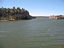 |
See also
- List of dams and reservoirs in Wyoming
- List of largest reservoirs in the United States
- List of rivers in Wyoming
- List of lakes in Wyoming
Notes
- ^ Volume given is the maximum flood pool, not the operational or live storage capacity.
- ^ Elevation given is the elevation of reservoir at full pool, measured in feet.
- ^ Jackson Lake is a natural lake, but was expanded with a dam first built in 1911, and enlarged in 1916.
- ^ The natural Bull Lake was expanded with the completion of Bull Lake Dam in 1938.
- ^ New Fork Lake was expanded with the creation of New Fork Lake Dam.
References
- ^ "Flaming Gorge Reservoir". Geographic Names Information System. United States Geological Survey, United States Department of the Interior. 1979-12-31. Retrieved 2014-12-22.
- ^ "Flaming Gorge Dam". United States Bureau of Reclamation. 2009-02-20. Retrieved 2014-12-22.
- ^ "Pathfinder Reservoir". Geographic Names Information System. United States Geological Survey, United States Department of the Interior. 1979-06-05. Retrieved 2014-12-22.
- ^ "Pathfinder Reservoir Allocations" (PDF). United States Bureau of Reclamation. Retrieved 2014-12-22.
- ^ "Seminoe Reservoir". Geographic Names Information System. United States Geological Survey, United States Department of the Interior. 1979-06-05. Retrieved 2014-12-22.
- ^ "Seminoe Reservoir Allocations" (PDF). United States Bureau of Reclamation. Retrieved 2014-12-22.
- ^ "Boysen Reservoir". Geographic Names Information System. United States Geological Survey, United States Department of the Interior. 1979-06-05. Retrieved 2014-12-22.
- ^ "Boysen Reservoir Allocations" (PDF). United States Bureau of Reclamation. Retrieved 2014-12-22.
- ^ "Jackson Lake". Geographic Names Information System. United States Geological Survey, United States Department of the Interior. 1979-06-05. Retrieved 2014-12-22.
- ^ a b "Jackson Lake Dam". United States Bureau of Reclamation. 2012-10-29. Archived from the original on 2012-10-17. Retrieved 2014-12-22.
- ^ "Glendo Reservoir". Geographic Names Information System. United States Geological Survey, United States Department of the Interior. 1979-06-05. Retrieved 2014-12-22.
- ^ "Glendo Reservoir Allocations" (PDF). United States Bureau of Reclamation. 2012-10-04. Retrieved 2014-12-22.
- ^ "Buffalo Bill Reservoir". Geographic Names Information System. United States Geological Survey, United States Department of the Interior. 1979-06-05. Retrieved 2014-12-22.
- ^ "Buffalo Bill Reservoir" (PDF). United States Bureau of Reclamation. 2012-10-03. Retrieved 2014-12-22.
- ^ "Fontenelle Reservoir". Geographic Names Information System. United States Geological Survey, United States Department of the Interior. 1979-06-05. Retrieved 2014-12-22.
- ^ "Fontenelle Dam". United States Bureau of Reclamation. 2009-02-20. Retrieved 2014-12-22.
- ^ "Keyhole Reservoir". Geographic Names Information System. United States Geological Survey, United States Department of the Interior. 1979-06-05. Retrieved 2014-12-22.
- ^ "Keyhole Unit". United States Bureau of Reclamation. 2011-05-11. Retrieved 2014-12-22.
- ^ "Alcova Reservoir". Geographic Names Information System. United States Geological Survey, United States Department of the Interior. 1979-06-05. Retrieved 2014-12-22.
- ^ "Alcova Reservoir Allocations" (PDF). United States Bureau of Reclamation. 2012-10-03. Retrieved 2014-12-22.
- ^ "Bull Lake". Geographic Names Information System. United States Geological Survey, United States Department of the Interior. 1979-06-05. Retrieved 2014-12-22.
- ^ "Bull Lake Allocations" (PDF). United States Bureau of Reclamation. 2012-10-03. Retrieved 2014-12-22.
- ^ "Wheatland Reservonir Number 2". Geographic Names Information System. United States Geological Survey, United States Department of the Interior. 1979-06-05. Retrieved 2014-12-22.
- ^ a b "Reservoirs in the United States" (PDF). United States Geological Survey. 1966. Retrieved 2014-12-22.
- ^ "New Fork Lake". Geographic Names Information System. United States Geological Survey, United States Department of the Interior. 1994-09-01. Retrieved 2014-12-22.
- ^ "Guernsey Reservoir". Geographic Names Information System. United States Geological Survey, United States Department of the Interior. 1979-06-05. Retrieved 2014-12-22.
- ^ "Guersey Reservoir Allocation" (PDF). United States Bureau of Reclamation. 2012-10-04. Retrieved 2014-12-22.
- v
- t
- e
projects
- Animas-La Plata Water Project
- Bostwick Park Project
- Central Utah Project
- Dallas Creek Project
- Dolores Project
- Eden Project
- Emery County Project
- Florida Project
- Hammond Project
- La Barge Project
- Lyman Project
- Navajo Indian Irrigation Project
- Paonia Project
- Pine River Project
- San Juan–Chama Project
- Seedskadee Project
- Silt Project
- Smith Fork Project
- Colorado River
- Green River
- Gunnison River
- San Juan River


