Mandoul Region
Region of Chad
8°54′36″N 17°33′00″E / 8.91000°N 17.55000°E / 8.91000; 17.55000
Region in Chad
Mandoul ماندول | |
|---|---|
Region | |
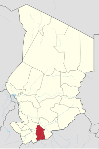 Map of Chad showing Mandoul. | |
| Country | Chad |
| Departments | 3 |
| Sub-prefectures | 15 |
| Regional capital | Koumra |
| Population (2009)[1] | |
| • Total | 628,065 |
Mandoul (Arabic: ماندول) is one of the 23 regions of Chad. Located in the south of the country, it comprises part of the former prefecture of Moyen-Chari. The regional capital is Koumra.
Geography
The region borders Tandjilé Region to the north-west, Moyen-Chari Region to the east, the Central African Republic to the south, and Logone Oriental Region to the west.
Settlements
Koumra the regional capital; other major settlements include Bébopen, Béboro, Bédaya, Bédjondo, Békamba, Békourou, Béssada, Bouna, Dembo, Goundi, Moïssala, Mouroum Goulaye, Ngangara and Peni.[2]
Demography
The population of Mandoul is 628,065 inhabitants, as per the Chadian census of 2009.[1] The main ethnolinguistic groups are the Day, Doba peoples (speaking the closely related Bedjond, Mango and Gor languages), Gulay, Lutos, Mbay, Ndam, Sara and Tumak.[3]
Economy
The main products are subsistence agriculture and cotton.[citation needed]
Subdivisions
The region of Mandoul is divided into three departments:
| Department | Capital (chef-lieu) | Sub-prefectures |
|---|---|---|
| Mandoul Occidental | Bédjondo | Bédjondo, Bébopen, Békamba, Peni |
| Mandoul Oriental | Koumra | Koumra, Bessada, Bédaya, Goundi, Ngangara, Mouroum Goulaye |
| Barh Sara | Moïssala | Moïssala, Beboro, Bekourou, Bouna, Dembo |
References
- ^ a b DEUXIEME RECENSEMENT GENERAL DE LA POPULATION ET DE L’HABITAT: RESULTATS GLOBAUX DEFINITIFS (PDF) (Report). INSEED. March 2012. p. 24. Archived from the original (PDF) on 24 September 2015. Retrieved 10 March 2017.
- ^ "Tchad - Région de Mandoul, Carte de référence (07 septembre 2018)" (PDF). Reliefweb. Retrieved 30 September 2019.
- ^ "Languages of Chad". Ethnologue. Retrieved 27 September 2019.
- v
- t
- e
- Bahr el Gazel
- Batha
- Borkou
- Chari-Baguirmi
- Ennedi-Est
- Ennedi-Ouest
- Guéra
- Hadjer-Lamis
- Kanem
- Lac
- Logone Occidental
- Logone Oriental
- Mandoul
- Mayo-Kebbi Est
- Mayo-Kebbi Ouest
- Moyen-Chari
- Ouaddaï
- Salamat
- Sila
- Tandjilé
- Tibesti
- Wadi Fira
- The city of N'Djamena (special statute region)
- Former regions: Borkou-Ennedi-Tibesti
- Ennedi

 | This Chad location article is a stub. You can help Wikipedia by expanding it. |
- v
- t
- e


