Meteren
Village in Gelderland, Netherlands

Flag

Coat of arms
51°51′50″N 5°16′57″E / 51.86391°N 5.28246°E / 51.86391; 5.28246
[1]
[2]
(2022)[1]
4194[1]
Meteren is a village in the Dutch province of Gelderland. It is a part of the municipality of West Betuwe, and lies about 10 km west of Tiel.
History
It was first mentioned in 1133 as Methre. The etymology is unclear.[3] The village developed in to a round esdorp. The tower of the Dutch Reformed Church dates from the 15th century and possibly has 14th century elements. The church itself is medieval, but was considerably altered in 1837 and around 1875.[4] In 1840, it was home to 529 people.[5]
Gallery
-
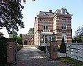 House in Meteren
 -
 Street view
 -
 Restaurant in Meteren
 -
 Huis Meteren before demolition (1907)


References
- ^ a b c "Kerncijfers wijken en buurten 2021". Central Bureau of Statistics. Retrieved 25 March 2022.
- ^ "Postcodetool for 4194AB". Actueel Hoogtebestand Nederland (in Dutch). Het Waterschapshuis. Retrieved 25 March 2022.
- ^ "Meteren - (geografische naam)". Etymologiebank (in Dutch). Retrieved 25 March 2022.
- ^ Ronald Stenvert & Sabine Broekhoven (2000). "Meteren" (in Dutch). Zwolle: Waanders. ISBN 90 400 9406 3. Retrieved 25 March 2022.
- ^ "Meteren". Plaatsengids (in Dutch). Retrieved 25 March 2022.
External links
 Media related to Meteren, Netherlands at Wikimedia Commons
 | This Gelderland location article is a stub. You can help Wikipedia by expanding it. |
- v
- t
- e


