Otterbourne, Kansas
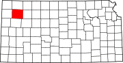
Ghost town in Thomas County, Kansas
Ghost town in Kansas, United States
39°30′50″N 100°58′53″W / 39.51389°N 100.98139°W / 39.51389; -100.98139Otterbourne is a ghost town in Thomas County, Kansas, United States.
History
Otterbourne was issued a post office in 1881. The post office was discontinued in 1897.[2]
References
- ^ "Otterbourne, Kansas", Geographic Names Information System, United States Geological Survey, United States Department of the Interior
- ^ "Kansas Post Offices, 1828-1961". Kansas Historical Society. Retrieved 2018-01-05.[permanent dead link]
Further reading
External links
- Thomas County maps: Current, Historic, KDOT
- v
- t
- e
Municipalities and communities of Thomas County, Kansas, United States
County seat: Colby
communities
- Copeland
- Cumberland
- Kuka
- Otterbourne
- Quickville
- Barrett
- East Hale
- Kingery
- Lacey
- Menlo
- Morgan
- North Randall
- Rovohl
- Smith
- South Randall
- Summers
- Wendell
- West Hale
‡This community also has portions in an adjacent county or counties.
- Kansas portal
- United States portal
 | This article about a location in Thomas County, Kansas is a stub. You can help Wikipedia by expanding it. |
- v
- t
- e


