Pınarhisar District
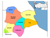
District of Kırklareli Province, Turkey
District in Kırklareli, Turkey
41°38′N 27°31′E / 41.633°N 27.517°E / 41.633; 27.517 (2022)
Pınarhisar District is a district of the Kırklareli Province of Turkey. Its seat is the town of Pınarhisar.[1] Its area is 518 km2,[2] and its population is 17,402 (2022).[3]
Composition
There are two municipalities in Pınarhisar District:[1][4]
There are 14 villages in Pınarhisar District:[5]
- Akören
- Ataköy
- Çayırdere
- Cevizköy
- Erenler
- Evciler
- Hacıfakılı
- İslambeyli
- Kurudere
- Osmancık
- Poyralı
- Sütlüce
- Tozaklı
- Yenice
References
- ^ a b İlçe Belediyesi, Turkey Civil Administration Departments Inventory. Retrieved 1 March 2023.
- ^ "İl ve İlçe Yüz ölçümleri". General Directorate of Mapping. Retrieved 1 March 2023.
- ^ "Address-based population registration system (ADNKS) results dated 31 December 2022, Favorite Reports" (XLS). TÜİK. Retrieved 13 March 2023.
- ^ Belde Belediyesi, Turkey Civil Administration Departments Inventory. Retrieved 1 March 2023.
- ^ Köy, Turkey Civil Administration Departments Inventory. Retrieved 1 March 2023.
- v
- t
- e
Pınarhisar District in Kırklareli Province of Turkey
- Babaeski
- Demirköy
- Kırklareli
- Kofçaz
- Lüleburgaz
- Pehlivanköy
- Pınarhisar
- Vize

| Istanbul | |
|---|---|
| West Marmara | |
| Aegean | |
| East Marmara | |
| West Anatolia | |
| Mediterranean | |
| Central Anatolia | |
| West Black Sea | |
| East Black Sea | |
| Northeast Anatolia | |
| Central East Anatolia | |
| Southeast Anatolia | |
Metropolitan municipalities are bolded.
 Pınarhisar District Pınarhisar District | |
|---|---|
| Municipalities | |
| Villages |
|
 | This geographical article about a location in Kırklareli Province, Turkey is a stub. You can help Wikipedia by expanding it. |
- v
- t
- e


