Peel, Arkansas
Unincorporated community in Arkansas, United States
36°25′56″N 92°46′08″W / 36.43222°N 92.76889°W / 36.43222; -92.76889[1]
72668
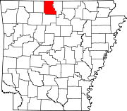
Peel is an unincorporated community in northwest Marion County, Arkansas, United States.[1] Peel is located on Arkansas Highway 125, 8 miles (13 km) east of Lead Hill. Peel has a post office with ZIP code 72668.[2] Bull Shoals Lake on the White River lies just to the north and east of the community.[3]
2024 Earthquakes
On January 4th and 5th 2024 four earthquakes were reported just to the southeast of the community. The strongest registered 2.5 on the Richter scale.[4]
References
- v
- t
- e
Municipalities and communities of Marion County, Arkansas, United States
County seat: Yellville
communities
- Arkansas portal
- United States portal
 | This article about a location in Marion County, Arkansas is a stub. You can help Wikipedia by expanding it. |
- v
- t
- e


