Rencheng, Jining
District in Shandong, People's Republic of China
Rencheng 任城区 | |
|---|---|
 Jining Great East Temple (济宁东大寺) | |
 Location in Jining | |
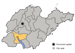 Jining in Shandong | |
| Country | People's Republic of China |
| Province | Shandong |
| Prefecture-level city | Jining |
| Area [1] | |
| • Total | 889 km2 (343 sq mi) |
| Population (2019)[2] | |
| • Total | 1,023,100 |
| • Density | 1,200/km2 (3,000/sq mi) |
| Time zone | UTC+8 (China Standard) |
| Postal Code | 272000 |
| Website | www |
Rencheng (Chinese: 任城; pinyin: Rènchéng) is one of two districts and the seat of the city of Jining in Shandong province, China. In November 2013 Shizhong District was merged into Rencheng.[3]
Administrative divisions
As 2013, this district is divided to 15 subdistricts and 5 townships.[4]
| Administrative level | Old Rencheng District | Former Shizhong District |
|---|---|---|
| Subdistricts | Xuzhuang Subdistrict (许庄街道) | Guhuai Subdistrict (古槐街道) |
| Liuxing Subdistrict (柳行街道) | Jiyang Subdistrict (济阳街道) | |
| Guanghe Subdistrict (洸河街道) | Fuqiao Subdistrict (阜桥街道) | |
| Liying Subdistrict (李营街道) | Yuehe Subdistrict (越河街道) | |
| Nanzhang Subdistrict (南张街道) | Nanfan Subdistrict (南苑街道) | |
| Jincheng Subdistrict (金城街道) | Guanyinge Subdistrict (观音阁街道) | |
| Xianying Subdistrict (仙营街道) | Anju Subdistrict (安居街道) | |
| Tangkou Subdistrict (唐口街道) | ||
| Towns | Nianlipu (廿里铺镇) | Yutun (喻屯镇) |
| Changgou (长沟镇) | ||
| Jiezhuang (接庄镇) | ||
| Shiqiao (石桥镇) |
Transportation
Jining railway station is located here.
References
- ^ 最新人口信息 www.hongheiku.com (in Chinese). hongheiku. Retrieved 2021-01-12.
- ^ 最新人口信息 www.hongheiku.com (in Chinese). hongheiku. Retrieved 2021-01-12.
- ^ 山东省人民政府关于调整济宁市部分行政区划的通知. Shandong Provincial Government. 2013-11-20. Archived from the original on 2014-01-08.
- ^ 济宁市-行政区划网 www.xzqh.org (in Chinese). XZQH. Retrieved 2012-05-24.
Wikimedia Commons has media related to Rencheng District.
- v
- t
- e
County-level divisions of Shandong Province
| Jinan | |
|---|---|
| Qingdao |
| Zibo | |
|---|---|
| Zaozhuang | |
| Dongying | |
| Yantai |
|
| Weifang |
|
| Jining | |
| Tai'an | |
| Weihai |
|
| Rizhao | |
| Linyi | |
| Dezhou | |
| Liaocheng | |
| Binzhou | |
| Heze |
35°24′24″N 116°36′00″E / 35.40667°N 116.60000°E / 35.40667; 116.60000
Authority control databases | |
|---|---|
| International |
|
| National |
|


