Samern

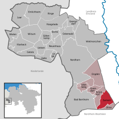
Samern is a community in the district of Grafschaft Bentheim in Lower Saxony, Germany.
Geography
Location
Samern lies between Nordhorn and Steinfurt on the boundary with North Rhine-Westphalia. The community belongs to the Joint Community (Samtgemeinde) of Schüttorf whose administrative seat is in the like-named town.
Politics
Mayor
The community’s honorary mayor is Gerhard Schepers.
Culture and sightseeing
The Mansbrügge watchtower, or in the local speech the Piggetörnken, was once, according to local lore, a mint belonging to a count in the 14th century. Newer findings, however, show that this building was only ever used as a customs post.
Sport
Samern has a sport club, SV Suddendorf-Samern 1959 e.V.
Economy and infrastructure
Transport
The Autobahn A 31 runs directly through the community of Samern.
References
- ^ "LSN-Online Regionaldatenbank, Tabelle A100001G: Fortschreibung des Bevölkerungsstandes, Stand 31. Dezember 2022" (in German). Landesamt für Statistik Niedersachsen.
External links
- Samern
- Joint Community’s website


