San Bartolome District
District in Lima, Peru
San Bartolome | |
|---|---|
District | |
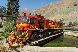 Locomotive on the turntable at San Bartolomé, Peru | |
| Country |  Peru Peru |
| Region | Lima |
| Province | Huarochirí |
| Founded | November 9, 1953 |
| Capital | San Bartolome |
| Government | |
| • Mayor | Rodrigo Enrique Chavez Vivas |
| Area | |
| • Total | 43.91 km2 (16.95 sq mi) |
| Elevation | 1,600 m (5,200 ft) |
| Population (2017) | |
| • Total | 1,139 |
| • Density | 26/km2 (67/sq mi) |
| Time zone | UTC-5 (PET) |
| UBIGEO | 150717 |
San Bartolome District is one of thirty-two districts of the Huarochirí Province, located in the Department of Lima in Peru.[1] The district was created by the Law No. 12001 in November 9, 1953, during the presidency of Manuel A. Odría. It encompasses an area of 43.91 km2.
km2 References
- ^ (in Spanish) Instituto Nacional de Estadística e Informática. Banco de Información Distrital Archived 2008-04-23 at the Wayback Machine. Retrieved April 11, 2008.
- v
- t
- e

- Districts of Lima Region
- Peru

- Antioquia
- Callahuanca
- Carampoma
- Chicla
- Cuenca
- Huachupampa
- Huanza
- Huarochirí
- Lahuaytambo
- Langa
- Laraos
- Mariatana
- Matucana
- Ricardo Palma
- San Andrés de Tupicocha
- San Antonio
- San Bartolome
- San Damian
- San Juan de Iris
- San Juan de Tantaranche
- San Lorenzo de Quinti
- San Mateo
- San Mateo de Otao
- San Pedro de Casta
- San Pedro de Huancayre
- Sangallaya
- Santa Cruz de Cocachacra
- Santa Eulalia
- Santiago de Anchucaya
- Santiago de Tuna
- Santo Domingo de los Olleros
- Surco
 | This Lima Region geography article is a stub. You can help Wikipedia by expanding it. |
- v
- t
- e
11°54′42″S 76°31′45″W / 11.9118°S 76.5292°W / -11.9118; -76.5292


