Sangi Takht District
District in Daykundi, Afghanistan
Sang-e-Takht سنگ تخت | |
|---|---|
District | |
| 34°11′24″N 65°54′36″E / 34.19000°N 65.91000°E / 34.19000; 65.91000 | |
| Country | Afghanistan |
| Province | Daykundi |
| Elevation | 2,450 m (8,040 ft) |
Sangi Takht or Sang‐e‐Takht (Dari: سنگ تخت), is a district in Daykundi Province in central Afghanistan.[2] It was created in 2005 from Daykundi district.
The Sangtakht-Bandar District has 290 villages. It has an area of 1,095 square kilometres (423 sq mi) and a population of 78,900. This district is limited by the Ghor Province and the Ashtarlay District of Daikundi.
The people of Sangtakht-Bandar District are typically farmers. This district lacks an asphalt road[citation needed] and its government office does not have the building.
A few villages in the district are Santakht, Bandar, Seyahchob, and Dorob.
References
- v
- t
- e
Districts of Afghanistan by province
| ||
|---|---|---|
| Districts | 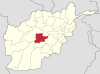 | |
| Landforms | ||
| Other | ||
 | This Daykundi Province, Afghanistan location article is a stub. You can help Wikipedia by expanding it. |
- v
- t
- e


