Tapting
Village development committee in Sagarmatha Zone, Nepal
Tapting टाप्टिङ | |
|---|---|
Village development committee | |
| 27°28′N 86°28′E / 27.47°N 86.47°E / 27.47; 86.47 | |
| Country | Nepal |
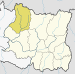
| Zone | Sagarmatha Zone |
| District | Solukhumbu District |
| Population (2015) | |
| • Total | 7,580 |
| Sherpa/Tamang/Magar etc. | |
| Time zone | UTC+5:45 (Nepal Time) |
| Website | https://www.facebook.com/Tapting.VDC |
Tapting is a village development committee in Solukhumbu District in the Sagarmatha Zone of north-eastern Nepal. At the time of the 1991 Nepal census it had a population of 2016 people living in 339 individual households. According to recent population research data in 2015,the population of Tapting VDC is 7580,living in 4850 individual households. Transportation--> = High Way Road is Connected from Capital Kathmandu to Tapting VDC. [1]
References
- ^ "Nepal Census 2001". Nepal's Village Development Committees. Digital Himalaya. Retrieved 14 November 2008.
External links
- UN map of the municipalities of Solukhumbu District
- v
- t
- e
Solukhumbu District
Headquarter: Salleri
- Solududhkunda
- Dudhakaushika
- Necha Salyan
- Dudhkoshi
- Maha Kulung
- Sotang
- Khumbu Pasang Lhamu
- Likhu Pike
 | This article about a location in Solukhumbu District, Nepal is a stub. You can help Wikipedia by expanding it. |
- v
- t
- e


