Towaoc, Colorado
Census-designated place in Montezuma County, Colorado, United States
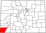
Census-designated place in Colorado, United States
37°12′45″N 108°43′35″W / 37.21250°N 108.72639°W / 37.21250; -108.72639 (Towaoc CDP, Colorado)[1] United States
 Colorado
[1]
[2]
(2020)[1]
81334
Towaoc[5] is a Census-designated place (CDP), a post office, and the capital of the Ute Mountain Ute Tribe located on the Ute Mountain Ute Reservation in Montezuma County, Colorado, United States. The Towaoc post office has the ZIP Code 81334 (post office boxes).[3] At the United States Census 2020, the population of the Towaoc CDP was 1,120.[1]
Geography
Towaoc is located east of Sleeping Ute Mountain, a sacred mountain of the Ute people, and northeast of the Four Corners Monument.
Old Towaoc, located at the base of Ute Mountain, is approximately 2 miles (3 km) west of US Highways 491-160, and includes various tribal and BIA governmental buildings and housing areas, including the tribal offices of the Ute Mountain Ute Tribe.[citation needed] In recent years, a small complex has been developed directly on US Highway 491–160 at the junction of the road into the original town.
The Towaoc CDP has an area of 2,294 acres (9.284 km2), all land.[1]
Education
The CDP is served by Montezuma-Cortez School District RE-1.
Demographics
| Year | Pop. | ±% |
|---|---|---|
| 1990 | 700 | — |
| 2000 | 1,097 | +56.7% |
| 2010 | 1,087 | −0.9% |
| 2020 | 1,120 | +3.0% |
| Source: United States Census Bureau | ||
The United States Census Bureau initially defined the Towaoc CDP for the 1990 United States Census.
| Languages (2000) [6] | Percent |
|---|---|
| Spoke English at home | 47.18% |
| Spoke Colorado River Numic at home | 45.99% |
| Spoke Navajo at home | 5.31% |
| Spoke Spanish at home | 1.08% |
| Spoke Cheyenne at home | 0.43% |
See also
 Colorado portal

References
- ^ a b c d e "State of Colorado Census Designated Places - BAS20 - Data as of January 1, 2020". United States Census Bureau. Retrieved November 5, 2021.
- ^ a b U.S. Geological Survey Geographic Names Information System: Towaoc, Colorado
- ^ a b "Look Up a ZIP Code". United States Postal Service. Retrieved December 24, 2020.
- ^ Eichler, Geo. R. (1977). Colorado Place Names. Boulder: Johnson Publishing Company. ISBN 978-0-933472-26-6.
- ^ Pronounced /tɔɪɔːk/ ⓘ.[4]
- ^ "Data Center Results".
External links
Wikimedia Commons has media related to Towaoc, Colorado.
- Towaoc @ Colorado.com
- Towaoc @ UncoverColorado.com
- Ute Mountain Ute Tribe website
- Ute Mountain Ute Tribal Park
- Ute Mountain Casino Hotel
- Montezuma County website
- v
- t
- e
Municipalities and communities of Montezuma County, Colorado, United States
County seat: Cortez
- Lewis
- Towaoc
communities
reservations
‡This populated place also has portions in an adjacent county or counties
- Colorado portal
- United States portal
Authority control databases | |
|---|---|
| International |
|
| National |
|


