Ulrichsberg
You can help expand this article with text translated from the corresponding article in German. (November 2016) Click [show] for important translation instructions.
- View a machine-translated version of the German article.
- Machine translation, like DeepL or Google Translate, is a useful starting point for translations, but translators must revise errors as necessary and confirm that the translation is accurate, rather than simply copy-pasting machine-translated text into the English Wikipedia.
- Do not translate text that appears unreliable or low-quality. If possible, verify the text with references provided in the foreign-language article.
- You must provide copyright attribution in the edit summary accompanying your translation by providing an interlanguage link to the source of your translation. A model attribution edit summary is
Content in this edit is translated from the existing German Wikipedia article at [[:de:Ulrichsberg]]; see its history for attribution. - You may also add the template
{{Translated|de|Ulrichsberg}}to the talk page. - For more guidance, see Wikipedia:Translation.
Place in Upper Austria, Austria

Coat of arms
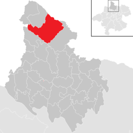
Location in the district
[1]
(2018-01-01)[2]
4161
Ulrichsberg is a municipality in the district of Rohrbach in the Austrian state of Upper Austria.
Geography
Ulrichsberg lies in Mühlviertel in Upper Austria near the Bohemian Forest and along the Große Mühl river (north of the Danube). It covers an area of 12.2 km north to south and 10.3 km east to west for a total area of 57 km2. 51.8% of the area is forested and 44.7% of the area is in agricultural use.
Nearby Gemeinden (municipalities) are: Berdetschlag, Breitenstein, Dietrichschlag, Erlet, Fuchslug, Hintenberg, Kandlschlag, Lichtenberg, Mühlwald, Ödenkirchen, Salnau, Schindlau, Seitelschlag, Sonnenwald, Stangl, Stollnberg, Ulrichsberg, and Zaglau. North of Lichtenberg, in Schöneben, is a small border crossing to the Czech Republic.
History
Ulrichsberg was first mentioned in a document in 1325.[citation needed]
References
Wikimedia Commons has media related to Ulrichsberg.
- v
- t
- e
Municipalities in the district of Rohrbach
- Aigen-Schlägl
- Altenfelden
- Arnreit
- Atzesberg
- Auberg
- Haslach an der Mühl
- Helfenberg
- Hofkirchen im Mühlkreis
- Hörbich
- Julbach
- Kirchberg ob der Donau
- Klaffer am Hochficht
- Kleinzell im Mühlkreis
- Kollerschlag
- Lembach im Mühlkreis
- Lichtenau im Mühlkreis
- Nebelberg
- Neufelden
- Neustift im Mühlkreis
- Niederkappel
- Niederwaldkirchen
- Oberkappel
- Oepping
- Peilstein im Mühlviertel
- Pfarrkirchen im Mühlkreis
- Putzleinsdorf
- Rohrbach-Berg
- Sankt Johann am Wimberg
- Sankt Martin im Mühlkreis
- Sankt Oswald bei Haslach
- Sankt Peter am Wimberg
- Sankt Stefan-Afiesl
- Sankt Ulrich im Mühlkreis
- Sankt Veit im Mühlkreis
- Sarleinsbach
- Schwarzenberg am Böhmerwald
- Ulrichsberg
Authority control databases | |
|---|---|
| International |
|
| National |
|
| Geographic |
|
 | This Upper Austria location article is a stub. You can help Wikipedia by expanding it. |
- v
- t
- e


