Warm Springs, Arkansas
Census-designated place in Arkansas, United States
36°28′59″N 91°02′56″W / 36.48306°N 91.04889°W / 36.48306; -91.04889[1] (2020)
72478
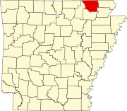
Warm Springs is an unincorporated community and census-designated place (CDP) in Randolph County, Arkansas, United States. Warm Springs is located on Arkansas Highway 251, 15.5 miles (24.9 km) north-northwest of Pocahontas. It was first listed as a CDP in the 2020 census with a population of 47.[2]
Warm Springs has a ZIP Code of 72478, but does not have a post office nor a collection box.[3]
Demographics
| Census | Pop. | Note | %± |
|---|---|---|---|
| 2020 | 47 | — | |
| U.S. Decennial Census[4] 2020[5] | |||
2020 census
| Race / Ethnicity | Pop 2020[5] | % 2020 |
|---|---|---|
| White alone (NH) | 36 | 76.60% |
| Black or African American alone (NH) | 0 | 0.00% |
| Native American or Alaska Native alone (NH) | 0 | 0.00% |
| Asian alone (NH) | 0 | 0.00% |
| Pacific Islander alone (NH) | 0 | 0.00% |
| Some Other Race alone (NH) | 0 | 0.00% |
| Mixed Race/Multi-Racial (NH) | 4 | 8.51% |
| Hispanic or Latino (any race) | 7 | 14.89% |
| Total | 47 | 100.00% |
References
- ^ a b c U.S. Geological Survey Geographic Names Information System: Warm Springs, Arkansas
- ^ "Warm Springs CDP, Arkansas". United States Census Bureau. Retrieved April 7, 2022.
- ^ "PO Locator | USPS".
- ^ "Decennial Census of Population and Housing by Decades". US Census Bureau.
- ^ a b "P2 HISPANIC OR LATINO, AND NOT HISPANIC OR LATINO BY RACE – 2020: DEC Redistricting Data (PL 94-171) – Warm Springs CDP, Arkansas". United States Census Bureau.
- v
- t
- e
Municipalities and communities of Randolph County, Arkansas, United States
County seat: Pocahontas
- Warm Springs
communities
- Arkansas portal
- United States portal
 | This article about a location in Randolph County, Arkansas is a stub. You can help Wikipedia by expanding it. |
- v
- t
- e


