Wheatland, Montana
Census-designated place in Montana, United States
45°54′12″N 111°36′0″W / 45.90333°N 111.60000°W / 45.90333; -111.60000[1]
[2]
(2020)
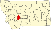
Wheatland is a census-designated place (CDP) in Broadwater County, Montana, United States. The population was 568 according to the 2010 census.[3]
Geography
Wheatland occupies a large area in the southern end of Broadwater County. U.S. Route 287 runs north-south through the CDP, intersecting Interstate 90 at Exit 274 of that highway. Montana Highway 2 leads east across the Jefferson River to the city of Three Forks in Gallatin County.
According to the United States Census Bureau, the Wheatland CDP has a total area of 76.2 square miles (197.3 km2), of which 75.6 square miles (195.9 km2) is land and 0.58 square miles (1.5 km2), or 0.74%, is water.[3]
Demographics
| Census | Pop. | Note | %± |
|---|---|---|---|
| 2020 | 1,103 | — | |
| U.S. Decennial Census[4] | |||
References
- ^ "ArcGIS REST Services Directory". United States Census Bureau. Retrieved September 5, 2022.
- ^ a b U.S. Geological Survey Geographic Names Information System: Wheatland, Montana
- ^ a b "Geographic Identifiers: 2010 Demographic Profile Data (G001): Wheatland CDP, Montana". U.S. Census Bureau, American Factfinder. Archived from the original on February 12, 2020. Retrieved June 26, 2013.
- ^ "Census of Population and Housing". Census.gov. Retrieved June 4, 2016.
- v
- t
- e
Municipalities and communities of Broadwater County, Montana, United States
County seat: Townsend
- Radersburg
- Spokane Creek
- The Silos
- Toston
- Wheatland
- Winston
community
- Montana portal
- United States portal


