Yukarışahinler
You can help expand this article with text translated from the corresponding article in Turkish. (July 2012) Click [show] for important translation instructions.
- Machine translation, like DeepL or Google Translate, is a useful starting point for translations, but translators must revise errors as necessary and confirm that the translation is accurate, rather than simply copy-pasting machine-translated text into the English Wikipedia.
- Do not translate text that appears unreliable or low-quality. If possible, verify the text with references provided in the foreign-language article.
- You must provide copyright attribution in the edit summary accompanying your translation by providing an interlanguage link to the source of your translation. A model attribution edit summary is
Content in this edit is translated from the existing Turkish Wikipedia article at [[:tr:Yukarışahinler]]; see its history for attribution. - You may also add the template
{{Translated|tr|Yukarışahinler}}to the talk page. - For more guidance, see Wikipedia:Translation.
Village in Artvin, Turkey
Yukarışahinler Jileni Napşit | |
|---|---|
Village | |
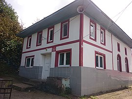 Mosque of the village | |
| 41°19′32″N 41°22′9″E / 41.32556°N 41.36917°E / 41.32556; 41.36917 | |
| Country | Turkey |
| Province | Artvin |
| District | Arhavi |
| Government | |
| • Muhtar | Turan Toraman |
| Elevation | 328 m (1,076 ft) |
| Population (2021) | 222 |
| Time zone | UTC+3 (TRT) |
Yukarışahinler is a village in the Arhavi District, Artvin Province, Turkey.[1] Its population is 222 (2021).[2]
History
It gained village status before 1965. The old name of village was "Jileni Napşit".[3][4]
Geography
Güvercinli is located to the north, Derecik is located to the south, Tepeyurt is located to the east, and Ulukent is located to the west of the village. The altitude of the village is 328 meters.[4] The climate of the village is in the Black Sea climate. The village is 87 km away from the city of Artvin and 11 km away from the Arhavi town center.
Economy
The villages economy is based on agriculture and animal husbandry. There are two place of tea intake belonging to Lipton and Çaykur in village.
Population
| Year | Pop. | ±% p.a. |
|---|---|---|
| 1985 | 441 | — |
| 1990 | 377 | −3.09% |
| 1997 | 197 | −8.86% |
| 2007 | 57 | −11.66% |
| 2012 | 151 | +21.51% |
| 2017 | 173 | +2.76% |
| 2021 | 222 | +6.43% |
| Source: Population censuses (1985-1997)[5][6][7] and TÜIK (2007-2021)[8] | ||
Mukhtar
Mukhtars according to selected years:
- 2009 - Turan Toraman
- 2004 - Coşkun Atalan
- 1999 - Coşkun Atalan
- 1994 - Coşkun Atalan
- 1989 - İmdat Yıldızbayrak
- 1984 - İmdat Yıldızbayrak
- 1977 - Mustafa Özyılmaz
- 1973 - Mustafa Özyılmaz
References
- ^ Köy, Turkey Civil Administration Departments Inventory. Retrieved 30 January 2023.
- ^ "Address-based population registration system (ADNKS) results dated 31 December 2021" (XLS) (in Turkish). TÜİK. Retrieved 30 January 2023.
- ^ "YukarıŞahinler". nisanyanmap.com. Retrieved 31 January 2023.
- ^ a b "Yukari Sahinler, Turkey Page". Fallingrain.com. Retrieved 31 January 2023.
- ^ "1985 General Census" (PDF) (in Turkish). Turkish Statistical Institute. 1986. Archived (PDF) from the original on 22 May 2021.
- ^ "1990 General Census" (PDF) (in Turkish). Turkish Statistical Institute. 1991. Archived (PDF) from the original on 31 August 2021.
- ^ "1997 Population Count" (PDF) (in Turkish). Turkish Statistical Institute. 1999. Archived (PDF) from the original on 30 October 2022.
- ^ "Population Of Municipalities, Villages And Quarters". TÜIK. Retrieved 31 January 2023.
- v
- t
- e

 | This geographical article about a location in Artvin Province, Turkey is a stub. You can help Wikipedia by expanding it. |
- v
- t
- e


