Zitenga (département)
Pour le village chef-lieu, voir Zitenga.

Ne doit pas être confondu avec Zimtenga (département).

Cet article est une ébauche concernant un département et une commune du Burkina Faso.
Vous pouvez partager vos connaissances en l’améliorant (comment ?) selon les recommandations des projets correspondants.
| Zitenga | |||
| Administration | |||
|---|---|---|---|
| Pays |  Burkina Faso Burkina Faso | ||
| Région | Plateau-Central | ||
| Province | Oubritenga | ||
| Statut | Département Commune rurale | ||
| Subdivisions | 46 villages | ||
| Chef-lieu | Zitenga | ||
| Démographie | |||
| Population | 41 739 hab. (2006[1]) | ||
| Géographie | |||
| Coordonnées | 12° 44′ 57″ nord, 1° 18′ 37″ ouest | ||
| Divers | |||
| Fuseau horaire | UTC +0 | ||
| Indicatif téléphonique | +226 | ||
| Localisation | |||
 Carte des départements de la province de l’Oubritenga. | |||
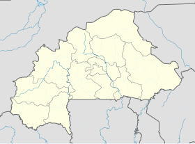
| Géolocalisation sur la carte : Burkina Faso
Géolocalisation sur la carte : Burkina Faso
| |||
modifier  | |||


Zitenga est un département et une commune rurale de la province de l’Oubritenga, situé dans la région du Plateau-Central au Burkina Faso.
Le département comptabilisait 41 739 habitants en 2006[1].
Villages
Le département et le commune rurale de Zitenga est administrativement composé de quarante-six villages, dont le village chef-lieu homonyme (données de population consolidées issues du recensement général de 2006[1]) :
- Andem (1 524 habitants)
- Bagtenga (926 habitants)
- Barkoundouba-Mossi (809 habitants)
- Bendogo (645 habitants)
- Bissiga-Mossi (1 818 habitants)
- Bissiga-Yarcé (560 habitants)
- Boalla (561 habitants)
- Dayagrétenga (1 034 habitants)
- Dimianéma (1 059 habitants)
- Itaoré (525 habitants)
- Kogmasgo (398 habitants)
- Kolgdiessé (459 habitants)
- Kologkom (445 habitants)
- Komnogo (463 habitants)
- Lallé (1 163 habitants)
- Leléxé (1 270 habitants)
- Lemnogo (1 386 habitants)
- Nagtaoli (288 habitants)
- Nambéguian (753 habitants)
- Nioniokodogo-Mossi (374 habitants)
- Nioniokodogo-Peulh (1 172 habitants)
- Nioniopalogo (701 habitants)
- Nonghin (1 427 habitants)
- Ouatinoma (1 010 habitants)
- Pendemtenga (1 461 habitants)
- Poédogo (485 habitants)
- Sadaba (3 887 habitants)
- Samtenga (377 habitants)
- Souka (567 habitants)
- Tamasgo (1 168 habitants)
- Tampanga (305 habitants)
- Tampèlga (1 053 habitants)
- Tampouy-Silmimossé (128 habitants)
- Tampouy-Yarcé (1 282 habitants)
- Tanghin (860 habitants)
- Tanghin Kossodo-Peulh (441 habitants)
- Tankounga (2 002 habitants)
- Tanlili (1 890 habitants)
- Tiba (444 habitants)
- Toanda (1 129 habitants)
- Yamana (1 206 habitants)
- Yanga (291 habitants)
- Yargo (877 habitants)
- Zakin (552 habitants)
- Zéguédéguin (323 habitants)
- Zitenga (241 habitants), chef-lieu
Notes et références
Liens externes
Articles connexes
| ||
|---|---|---|
| Ganzourgou |
|  |
| Kourwéogo |
| |
| Oubritenga |
| |
Annexes :
Autres régions :
| ||
 Portail du Burkina Faso


