Stimpfach
| Stimpfach comune | |
|---|---|
 | |
 | |
| Localizzazione | |
| Stato |  Germania Germania |
| Land |  Baden-Württemberg Baden-Württemberg |
| Distretto | Stoccarda |
| Circondario | Schwäbisch Hall |
| Territorio | |
| Coordinate | 49°03′44″N 10°05′24″E49°03′44″N, 10°05′24″E (Stimpfach) |
| Altitudine | 450 m s.l.m. |
| Superficie | 33,35 km² |
| Abitanti | 3 117[1] (31-12-2022) |
| Densità | 93,46 ab./km² |
| Altre informazioni | |
| Cod. postale | 74597 |
| Prefisso | 07967 |
| Fuso orario | UTC+1 |
| Codice Destatis | 08 1 27 104 |
| Targa | SHA |
| Cartografia | |
  Stimpfach | |
| Sito istituzionale | |
| Modifica dati su Wikidata · Manuale | |
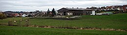
Stimpfach è un comune tedesco di 3 117 abitanti,[1], situato nel land del Baden-Württemberg.
Il suo territorio è bagnato dal fiume Jagst.
Note
Altri progetti
Altri progetti
- Wikimedia Commons
 Wikimedia Commons contiene immagini o altri file su Stimpfach
Collegamenti esterni
- Sito ufficiale, su stimpfach.de.


V · D · M Comuni del circondario di Schwäbisch Hall  | |
|---|---|
| Città | Crailsheim · Gaildorf · Gerabronn · Ilshofen · Kirchberg an der Jagst · Langenburg · Schrozberg · Schwäbisch Hall · Vellberg |
| Comuni | Blaufelden · Braunsbach · Bühlertann · Bühlerzell · Fichtenau · Fichtenberg · Frankenhardt · Kreßberg · Mainhardt · Michelbach an der Bilz · Michelfeld · Oberrot · Obersontheim · Rosengarten · Rot am See · Satteldorf · Stimpfach · Sulzbach-Laufen · Untermünkheim · Wallhausen · Wolpertshausen |
| Controllo di autorità | VIAF (EN) 239641694 · GND (DE) 4550707-7 |
|---|
 Portale Germania: accedi alle voci di Wikipedia che parlano della Germania


