Kents Hill, Monkston and Brinklow
| Kents Hill, Monkston and Brinklow | |||
|---|---|---|---|
 | |||
| Land |  Storbritannia Storbritannia | ||
| Konst. land |  England England | ||
| Distrikt | Milton Keynes | ||
| Admin. grevskap | Enhetlig myndighet | ||
| Seremon. grevskap | Buckinghamshire | ||
| Status | Verdslig sogn | ||
| Befolkning | 4 545 (2001) | ||
 Kents Hill, Monkston and Brinklow 52°01′43″N 0°41′42″V | |||
Kents Hill, Monkston and Brinklow på Commons | |||
Kents Hill, Monkston and Brinklow er et verdslig sogn i Milton Keynes. Det ble opprettet i 2001, da distriktet ble delt inn i sogn.
Sognet omfatter som navnet sier Kents Hill, Brinklow og Monkston, og er avgrenset av Chaffron Way, Broughton Brook, Newport Road, Groveway, Brickhill Street, Standing way og elven Ouzel.
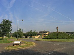
I den vestlige delen av Kents Hill finner man Open University, og i Brinklow finner man et lite industriområde som domineres av Waitroses distribusjonssenter. Ellers består sognet for det meste av bolig- og naturområder.
- v
- d
- r
Verdslige sogn i distriktet Milton Keynes
- Astwood
- Bletchley and Fenny Stratford
- Bow Brickhill
- Bradwell
- Bradwell Abbey
- Broughton
- Calverton
- Campbell Park
- Castlethorpe
- Central Milton Keynes
- Chicheley
- Clifton Reynes
- Cold Brayfield
- Emberton
- Gayhurst
- Great Linford
- Hanslope
- Hardmead
- Haversham med Little Linford
- Kents Hill, Monkston and Brinklow
- Lathbury
- Lavendon
- Little Brickhill
- Loughton
- Middleton
- Moulsoe
- New Bradwell
- Newport Pagnell
- Newton Blossomville
- North Crawley
- Olney
- Ravenstone
- Shenley Brook End
- Shenley Church End
- Sherington
- Simpson
- Stantonbury
- Stoke Goldington
- Stony Stratford
- Tyringham and Filgrave
- Walton
- Warrington
- Wavendon
- West Bletchley
- Weston Underwood
- Woburn Sands
- Wolverton and Greenleys
- Woughton


