Knox County (Maine)
| Knox County i Maine | |||
|---|---|---|---|
 | |||
| Grunnlagt | 1860 | ||
| Oppkalt etter | Henry Knox | ||
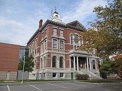
| Fylkessete | Rockland | ||
| Største by | Rockland | ||
| Areal - Totalt - Land - Vann | 2 958,03 km² 947,08 km² 2 010,95 km² | ||
| Befolkning - Tetthet | 41 096 (2006) 13,89 innb./km² | ||
 Knox County 44°07′12″N 69°07′40″V | |||
Knox County på Commons | |||
Knox County er et fylke i den amerikanske delstaten Maine. Det ligger i de sørlige delene av staten og det grenser mot Waldo County i nord, Lincoln County i vest og mot Atlanterhavet i sør og øst.
Knox Countys totale areal er 2 958 km² hvorav 2 011 km² er vann. I 2000 hadde fylket 39 618 innbyggere og administrasjonssenteret ligger i byen Rockland.
Fylket ble grunnlagt i 1860 av land fra fylkene Lincoln og Waldo County.
Byer
- Appleton
- Camden
- Cushing
- Friendship
- Hope
- Isle au Haut
- Matinicus Isle
- North Haven
- Owls Head
- Rockland
- Rockport
- South Thomaston
- St. George
- Thomaston
- Union
- Vinalhaven
- Warren
- Washington
Eksterne lenker
- (en) Offisielt nettsted

- (en) Knox County, Maine – kategori av bilder, video eller lyd på Commons
- Knox County Charter
- Maine Genealogy: Knox County, Maine
| ||||||||||||||


| |||
|---|---|---|---|
 | Fylker | Androscoggin · Aroostook · Cumberland · Franklin · Hancock · Kennebec · Knox · Lincoln · Oxford · Penobscot · Piscataquis · Sagadahoc · Somerset · Waldo · Washington · York |  |
| Byer | Auburn · Augusta · Bangor · Bath · Belfast · Biddeford · Brewer · Caribou · Ellsworth · Houlton · Kittery · Lewiston · Millinocket · Old Orchard Beach · Old Town · Orono · Portland · Presque Isle · Rockland · Rumford · Saco · Sanford · South Portland · Stockholm · Topsham · Waterville · Westbrook | ||


