Kirklees
 | Ten artykuł dotyczy dystrykt. Zobacz też: inne znaczenia. |
| Dystrykt metropolitalny | |||
 Huddersfield | |||
| |||
| Państwo |
| ||
|---|---|---|---|
| Kraj |
| ||
| Region | |||
| Hrabstwo | West Yorkshire | ||
| Siedziba | Huddersfield | ||
| Powierzchnia | 409 km² | ||
| Populacja (2016) • liczba ludności |
| ||
| • gęstość | 1069 os./km² | ||
Położenie na mapie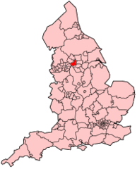 | |||
| |||
| Strona internetowa | |||


Kirklees – dystrykt metropolitalny w angielskim hrabstwie West Yorkshire. Największym miastem dystryktu, a także ośrodkiem administracji jest Huddersfield.
Miasta
- Batley
- Cleckheaton
- Dewsbury
- Heckmondwike
- Holmfirth
- Huddersfield
- Mirfield
Inne miejscowości
Almondbury, Armitage Bridge, Battyeford, Berry Brow, Birdsedge, Birkenshaw, Birstall, Boothroyd, Bradley, Briestfield, Burnlee, Cartworth, Clayton West, Dalton, Denby Dale, Emley, Farnley Tyas, Flockton, Flockton Moor, Fulstone, Golcar, Gomersal, Grange Moor, Hall Bower, Hartshead, Healey, Helme, Hepworth, Highburton, Holme, Holme Valley, Honley, Hunsworth, Kirkburton, Kirkheaton, Lane, Lepton, Lindley, Linthwaite, Liversedge, Lockwood, Lower Cumberworth, Marsden, Meltham, Netherthong, Netherton, New Mill, Newsome, Norristhorpe, Ravensthorpe, Roberttown, Scammonden, Scholes (Cleckheaton), Scholes (Holme Valley), Scissett, Shelley, Shepley, Skelmanthorpe, Slaithwaite, South Crosland, Stocksmoor, Storthes Hall, Thongsbridge, Thornhill, Thurstonland, Totties, Upper Cumberworth, Upper Denby (Denby Dale), Upper Denby (Kirkburton), Upperthong, Whitley Lower, Wooldale.
Przypisy
- ↑ Population Estimates for UK, England and Wales, Scotland and Northern Ireland - Office for National Statistics [online], www.ons.gov.uk [dostęp 2017-10-22] (ang.).
- Britannica: place/Kirklees


