Bátonyterenye
| Bátonyterenye | |||
| Stad | |||
 Medeltidskyrkan i Maconka | |||
| |||
| Land |  Ungern Ungern | ||
|---|---|---|---|
| Provins | Nógrád | ||
| Koordinater | 47°59′26″N 19°49′51″Ö / 47.99060°N 19.83091°Ö / 47.99060; 19.83091 | ||
| Yta | 80,09 km² | ||
| Folkmängd | 11 616 (2019)[1] | ||
| Befolkningstäthet | 145 invånare/km² | ||
| Geonames | 3055287 | ||
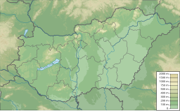  Bátonyterenyes läge i Ungern | |||
| Webbplats: http://www.batonyterenye.hu | |||


Bátonyterenye är en stad i Ungern.
Källor
- ^ ”Detailed Gazetteer of Hungary” (på engelska). http://www.ksh.hu/apps/hntr.telepules?p_lang=EN&p_id=33534. Läst 26 maj 2020.


