2014 Nagano earthquake
Earthquake in Japan
Mw (USGS)6.7 MJMA (JMA)
JMA 6−
On November 22, 2014, at 22:08 local time (UTC +9), an earthquake struck southeast of Hakuba, Nagano Prefecture. It had a magnitude of 6.2 Mw according to the United States Geological Survey, with a maximum intensity assigned IX (Violent) on the Modified Mercalli intensity scale. According to the Japan Meteorological Agency, it is recorded as 6.7 MJMA and at its peak intensity at Shindo 6 Lower on the Japan Meteorological Agency seismic intensity scale.[1][2] The earthquake did not result in any deaths, however 41 people sustained mild to severe injuries.
Earthquake

The quake was generated by the movement of the Kamishiro fault. The focal mechanism of which suggested reverse faulting on an eastward-dipping fault extending in the north–south direction. The quake was also had a pressure axis in the west-northwest-east-southeast direction, and is considered to be a shallow earthquake. According to the report of GNSS observations, crustal movements of about 29 cm directing southeast and some subsidence of an estimated 13 cm going the vertical direction were observed at the Hakuba observation point, located in Nagano with the occurrence of the mainshock. In addition, the analysis results from the synthetic aperture radar image according to the Advanced Land Observing Satellite-2 "DAICHI-2", the area of crustal movement spreads across the area of about 30 km east–west and about 30 km north–south centering on the village of Hakuba. In particular, large fluctuations can be seen along the Kamishiro fault to the west of the epicenter of the main earthquake. From these crustal movements, the length of the source fault that caused the slip is estimated to be about 20 km. In at field survey, a surface seismic fault was confirmed in the section of about 9 km from Hakuba Village in Hokujo to Hakuba Village near Kamishiro. In the surrounding areas of Hokujo Shiojima in Hakuba Village located near the west of the epicenter of the mainshock, a surface deformation of the eastern uplift with a vertical displacement of up to about 90 cm was confirmed. The Kamishiro fault, which is part of the Itoigawa-Shizuoka Tectonic Line active fault system, exists near this epicenter area. It is probable that a part of the Kamishiro fault and its northern extension were active in this earthquake.[3][4]
Intensity
| Intensity | Prefecture | Location |
|---|---|---|
| 6- | Nagano | Nagano (city), Togakushi, Kinasa, Otari Village, Ogawa Village, Nakaotarihei, Takafu |
| 5+ | Nagano | Toyono, Hakuba, Shinano, Hakoshimizu |
| Niigata | Nakajo | |
| 5− | Niigata | Joetsu, Niigata (city), Itoigawa, Sekikawa, Myoko |
| Nagano | Shinshushin-Shinmachi, Nakano, Omachi, Toyotsu, Iizuna, Yazaka, Mure, |
Impacts


Damage
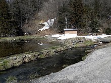
In the Oide district of the Hakuba village near the epicenter and where most ground ruptures were observed, no damage was observed. Instead, damage was observed in the Horonouchi and Mikkaichiba areas which were apparently 3 kilometers south of the epicenter. Some have speculated that the reason why damage was mostly concentrated in Horonouchi was due to soft ground and sedimentary rock in the area, but some speculate that it was due to its location between complex displacement zones.[6]
Evacuation and temporary housing
On November 23, an evacuation advisory was held for the town of Otari for 69 people from 31 households due to the mass damage and difficulties that were caused by the earthquake.[7] By November 28, 81 people in 40 households as well as 258 people from 110 households were evacuated.[8]
In Hakuba, it was decided to build about 35 temporary housing units for the people that were affected. As of mid-December, more than 90 people were living in secondary evacuation facilities such as accommodation facilities due to damage to their houses. Of these, 76 people are scheduled to move into 33 households, targeting residents who have been certified as completely or partially destroyed and those who have been instructed to evacuate due to landslides. The village is considering renting private housing when the number of units is insufficient.[9] The village of Otari however, had no plans of making new temporary housing for the residents. Instead they planned to rebuild and renew existing houses that were severely damaged and destroyed.
Electricity
According to the Chubu Electric power, the main electric supplier of the Chubu region, 1,760 households lost power and reduced to 180 units by 11 o'clock.[8] The Himekawa second power plant and hydroelectric power plant, as well as the Minaminomata power plant on the other hand, was forced to shut down.[7]
Water supply
According to the Nagano Prefecture Disaster Countermeasures Headquarters, water outages occurred in about 420 households in Nagano City, 270 households in Hakuba, 180 households in Otari and about 20 houses in Omachi.[8] A day after the earthquake water outages also occurred in Ogawa and Iiyama but were immediately restored.[8]
Transportation
Traffic disturbances occurred due to landslides in Hakuba, Hokujo, Nitta and Otari. However, by December 3, most were lifted due to easy clearance or roads. Some roads most notably, Highway No. 406, were still closed due to assessment of displacement and liquefaction.[8]
See also
Wikimedia Commons has media related to 2014 Northern Nagano earthquake.
References
- ^ "M 6.2 - 6 km SSE of Hakuba, Japan". earthquake.usgs.gov. Archived from the original on 2019-06-20. Retrieved 2021-10-05.
- ^ "気象庁|報道発表資料". www.jma.go.jp. Retrieved 2021-10-05.
- ^ "2014年11月22日長野県北部の地震の評価". www.jishin.go.jp. Retrieved 2021-10-06.
- ^ "気象庁|報道発表資料". www.jma.go.jp. Retrieved 2021-10-06.
- ^ "sokuho.pdf" (PDF). Archived (PDF) from the original on 2014-12-02.
- ^ Suzuki, Yasuhiro; Hirouchi, Daisuke; Watanabe, Mitsuhisa (2015). "Issues raised by the 2014 Kamishiro Fault Earthquake, central Japan". Proceedings of the General Meeting of the Association of Japanese Geographers. 2015s: 100262. doi:10.14866/ajg.2015s.0_100262.
- ^ a b "長野県北部を震源とする地震の被害状況等について : 防災情報のページ - 内閣府". www.bousai.go.jp. Retrieved 2021-10-17.
- ^ a b c d e "8月5日~6日大雨による県内への影響について" (PDF). www.bousai.go.jp.
- ^ INC, SANKEI DIGITAL (2014-12-09). "白馬村仮設住宅着工、年内入居へ". 産経ニュース (in Japanese). Retrieved 2021-10-17.
36°38′28″N 137°53′17″E / 36.641°N 137.888°E / 36.641; 137.888
- v
- t
- e
- 679 Tsukushi
- 684 Hakuho
- 869 Jōgan
- 1293 Kamakura
- 1361 Shōhei
- 1498 Meiō
- 1586 Tenshō
- 1596 Fushimi
- 1605 Keichō
- 1611 Aizu
- 1611 Sanriku
- 1662 Kanbun
- 1662 Hyūga-nada
- 1677 Bōsō
- 1703 Genroku
- 1707 Hōei
- 1741 Kampo
- 1751 Takada
- 1771 Great Yaeyama
- 1792 Unzen
- 1804 Kisakata
- 1828 Sanjō
- 1833 Shōnai
- 1847 Zenkoji
- 1854 Iga–Ueno
- 1854 Nankai
- 1854 Tōkai
- 1855 Edo
- 1858 Hietsu
- 1872 Hamada
- 1889 Kumamoto
- 1891 Mino–Owari
- 1894 Tokyo
- 1894 Shōnai
- 1896 Sanriku
- 1896 Rikuu
- 1909 Anegawa
- 1911 Kikai Island
- 1914 Senboku
- 1922 Shimabara
- 1923 Great Kantō
- 1925 North Tajima
- 1927 North Tango
- 1930 North Izu
- 1933 Sanriku
- 1936 Miyagi
- 1939 Oga
- 1940 Shakotan
- 1941 Hyūga-nada
- 1943 Tottori
- 1944 Tōnankai
- 1945 Mikawa
- 1946 Nankai
- 1948 Fukui
- 1952 Tokachi
- 1961 North Mino
- 1963 Kuril Islands
- 1964 Niigata
- 1968 Ebino
- 1968 Hyūga-nada
- 1968 Tokachi
- 1973 Nemuro Peninsula
- 1974 Izu Peninsula
- 1978 Izu Ōshima
- 1978 Miyagi
- 1982 Urakawa
- 1983 Sea of Japan
- 1984 Nagano
- 1993 Kushiro
- 1993 Okushiri
- 1994 offshore Sanriku
- 1995 Hanshin
- 2000 Izu Islands
- 2000 Tottori
- 2001 Geiyo
- 2003 Miyagi
- 2003 Tokachi
- 2004 Chūetsu
- 2005 Fukuoka
- 2005 Miyagi
- 2006 Kuril Islands
- 2007 Chūetsu
- 2007 Kuril Islands
- 2007 Noto
- 2008 Iwate–Miyagi
- 2008 Iwate
- 2009 Shizuoka
- 2011 Tōhoku
- 2011 Nagano
- 2011 Shizuoka
- 2011 Miyagi
- 2011 Fukushima
- 2012 Chiba
- 2012 Sanriku
- 2014 Nagano
- 2015 Ogasawara
- 2016 Kumamoto
- 2016 Tottori
- 2016 Fukushima
- 2018 Osaka
- 2018 Hokkaido Eastern Iburi
- 2019 Yamagata
- 2021 Fukushima
- 2021 Miyagi
- 2021 Chiba
- 2022 Fukushima
- 2023 Noto
- 2024 Noto
- 2024 Hyūga-nada


