Little Costilla Peak
Mountain summit in the Culebra Range of New Mexico


Little Costilla Peak
US State of New Mexico
Ash Mountain, New Mexico[2]
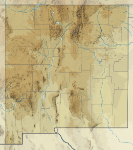
Little Costilla Peak is a 12,589-foot (3,837 m) mountain summit of the Culebra Range in the US State of New Mexico. Little Costilla Peak is located on the hydrological divide between Colfax County and Taos County in Carson National Forest 13.3 miles (21.4 km) northeast of Red River, New Mexico. Little Costilla Peak is the highest point in Colfax County, New Mexico.
Mountain
As the sixth highest major summit of New Mexico, Little Costilla Peak is a popular hiking destination. Somewhat higher but less prominent, Big Costilla Peak is located 7.5 miles (12.1 km) to the northwest.
Climate
| Climate data for Little Costilla Peak 36.8335 N, 105.2226 W, Elevation: 12,172 ft (3,710 m) (1991–2020 normals) | |||||||||||||
|---|---|---|---|---|---|---|---|---|---|---|---|---|---|
| Month | Jan | Feb | Mar | Apr | May | Jun | Jul | Aug | Sep | Oct | Nov | Dec | Year |
| Mean daily maximum °F (°C) | 27.5 (−2.5) | 28.2 (−2.1) | 33.9 (1.1) | 39.2 (4.0) | 47.9 (8.8) | 59.2 (15.1) | 62.7 (17.1) | 60.8 (16.0) | 55.2 (12.9) | 45.3 (7.4) | 34.8 (1.6) | 27.5 (−2.5) | 43.5 (6.4) |
| Daily mean °F (°C) | 17.0 (−8.3) | 17.3 (−8.2) | 22.4 (−5.3) | 27.5 (−2.5) | 36.0 (2.2) | 46.2 (7.9) | 50.3 (10.2) | 48.9 (9.4) | 43.5 (6.4) | 34.2 (1.2) | 24.6 (−4.1) | 17.4 (−8.1) | 32.1 (0.1) |
| Mean daily minimum °F (°C) | 6.6 (−14.1) | 6.5 (−14.2) | 10.9 (−11.7) | 15.7 (−9.1) | 24.2 (−4.3) | 33.3 (0.7) | 37.9 (3.3) | 37.1 (2.8) | 31.8 (−0.1) | 23.1 (−4.9) | 14.4 (−9.8) | 7.3 (−13.7) | 20.7 (−6.3) |
| Average precipitation inches (mm) | 1.95 (50) | 2.37 (60) | 3.14 (80) | 3.14 (80) | 2.06 (52) | 1.43 (36) | 3.38 (86) | 3.61 (92) | 2.16 (55) | 1.92 (49) | 2.32 (59) | 2.34 (59) | 29.82 (758) |
| Source: PRISM Climate Group[3] | |||||||||||||
See also
- New Mexico
- Geography of New Mexico
- List of mountain peaks of New Mexico
- Category:Mountains of New Mexico
- List of mountain peaks of New Mexico
- Geography of New Mexico
References
- ^ a b c "Little Costilla Peak, New Mexico". Peakbagger.com. Retrieved June 29, 2022.
- ^ a b "Little Costilla Peak". Geographic Names Information System. United States Geological Survey, United States Department of the Interior. Retrieved June 29, 2022.
- ^ "PRISM Climate Group, Oregon State University". PRISM Climate Group, Oregon State University. Retrieved November 1, 2023.
To find the table data on the PRISM website, start by clicking Coordinates (under Location); copy Latitude and Longitude figures from top of table; click Zoom to location; click Precipitation, Minimum temp, Mean temp, Maximum temp; click 30-year normals, 1991-2020; click 800m; click Retrieve Time Series button.
External links
- New Mexico state government website
- Colfax County, New Mexico government website
- Taos County, New Mexico government website
- Little Costilla Peak at Carson National Forest
- Little Costilla Peak at alltrails.com
- Little Costilla Peak at gaiagps.com
- Little Costilla Peak at mountainzone.com
- Little Costilla Peak at peakbook.org
- Little Costilla Peak at peakery.com
- Little Costilla Peak at peakvisor.com
- Little Costilla Peak at summitpost.org
- Little Costilla Peak at youtube.com
- v
- t
- e
State of New Mexico
Santa Fe (capital)
- Index
- Census-designated places
- Cuisine
- Culture
- Delegations
- Geography
- Government
- History
- Landmarks
- Military
- Music
- New Mexicans
- Hispanos
- Pueblos and Tribes
- Paleontology
- Symbols
- Tourist attractions
- Transportation
- Apachian zone
- Central New Mexico
- Chicoma Mountain
- Chihuahuan Desert
- Colorado Plateau
- Eastern New Mexico
- Llano Estacado
- Manzano Mountains
- Mogollon Plateau
- Northern New Mexico
- Permian Basin
- Rio Grande
- Rocky Mountains
- San Juan Basin
- San Luis Valley
- Sandia Mountains
- Shortgrass prairie
- Sangre de Cristo Mountains
- Wheeler Peak (highest point)
- Southwestern New Mexico
 New Mexico portal


